Obernberg am Brenner geodata
Obernberg am Brenner (Tyrol) is a seat of a third-order administrative division; located in Austria in Europe/Vienna (GMT+2) time zone. With population of 363 people, there are 2669 cities with bigger population in this country. Compared to other cities in Austria, 83.6% of cities are located further ↑North; 92.1% of cities are located further →East and 99.3% of cities have lower elevation than Obernberg am Brenner. Note1
Administrative division(s):
- Level 1: Tyrol
- Level 2: Politischer Bezirk Innsbruck Land
- Level 3: Obernberg am Brenner


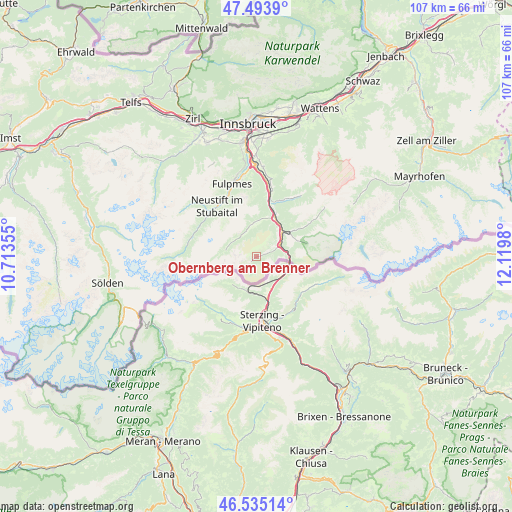
Obernberg am Brenner GPS coordinates[2]
47° 1' 0.012" North, 11° 25' 0.012" East
| Map corner | latitude | longitude |
|---|---|---|
| Upper-left | 47.4939°, | 10.71355° |
| Center: | 47.01667°, | 11.41667° |
| Lower-right: | 46.53514°, | 12.1198° |
| Map W x H: | 106.6×106.6 km | = 66.2×66.2mi |
| max Lat: | 48.98333° ⇑83.6% North |
| Obernberg am Brenner: | 47.01667° |
| min Lat: | ⇓16.4% South 46.48841° |
| min Long | Obernberg am Br | max Long |
| 9.57802° | 11.41667° | 17.1° |
| W 7.9%⇐ | ⇒92.1% E |
Elevation
Elevation of Obernberg am Brenner is 1424 m = 4672 ft, and this is 918.5 m = 3013 ft above average elevation for this country.
| Max E: |
2140 m = 7021 ft | 0.7% |
| Obernberg am Brenner | 1424 m 4672 ft | |
| Avg. | 505.5 m = 1658 ft | |
Min E: |
118 m = 387 ft | 99.3% |
See also: Austria elevation on elevation.city.
Geographical zone
Obernberg am Brenner is located in North temperate zone (between Tropic of Cancer and the Arctic Circle). Distance of this North polar circle is 2173.4 km =1350.5 mi to North.| Distance of | km | miles | from Obernberg am Brenner |
|---|---|---|---|
| North Pole | 4779.3 | 2969.7 | to North |
| Arctic Circle | 2173.4 | 1350.5 | to North |
| Tropic Cancer | 2621.8 | 1629.1 | to South |
| Equator | 5227.8 | 3248.4 | to South |


Nearby cities:
15 places around Obernberg am Brenner: (largest is in red/bold)
• Ausserweg
13.9 km =8.6 mi,  21°
21°
• Außerschmirn
11.5 km =7.1 mi,  50°
50°
• Gries am Brenner
5.5 km =3.4 mi,  63°
63°
• Gschnitz
5.9 km =3.7 mi,  302°
302°
• Matrei am Brenner
12.7 km =7.9 mi,  12°
12°
• Mauern
10 km =6.2 mi, 22°
• Mühlbachl
13.2 km =8.2 mi, 11°
• Neustift im Stubaital
13.5 km =8.4 mi,  325°
325°
• Pfons
14.3 km =8.9 mi, 13°
• Schmirn
13.6 km =8.5 mi, 56°
• Schöfens
13.5 km =8.4 mi, 14°
• Statz
11.4 km =7.1 mi, 12°
• Steinach am Brenner
8.3 km =5.2 mi,  27°
27°
• Trins
7.4 km =4.6 mi,  0°
0°
• Vals
9.4 km =5.8 mi,  70°
70°
Sources, notices
• [Note1] Compared only with cities in Austria existing in our database
• [Src1] Map data: © OpenStreetMap contributors (CC-BY-SA)
• [Src2] Other city data from geonames.org with taken over terms of usage.
• [Src3] Geographical zone / Annual Mean Temperature by Robert A. Rohde @ Wikipedia
