Rofansiedlung geodata
Rofansiedlung (Tyrol) is a populated place; located in Austria in Europe/Vienna (GMT+2) time zone. With population of 701 people, there are 1852 cities with bigger population in this country. Compared to other cities in Austria, 59% of cities are located further ↑North; 90.1% of cities are located further →East and 71.7% of cities have lower elevation than Rofansiedlung. Note1


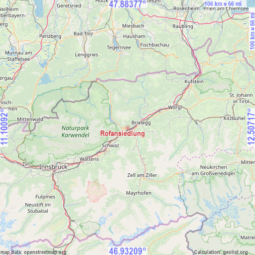
Rofansiedlung GPS coordinates[2]
47° 24' 36.288" North, 11° 48' 14.544" East
| Map corner | latitude | longitude |
|---|---|---|
| Upper-left | 47.88377°, | 11.10092° |
| Center: | 47.41008°, | 11.80404° |
| Lower-right: | 46.93209°, | 12.50717° |
| Map W x H: | 105.8×105.8 km | = 65.7×65.7mi |
| max Lat: | 48.98333° ⇑59% North |
| Rofansiedlung: | 47.41008° |
| min Lat: | ⇓41% South 46.48841° |
| min Long | Rofansiedlung | max Long |
| 9.57802° | 11.80404° | 17.1° |
| W 9.9%⇐ | ⇒90.1% E |
Elevation
Elevation of Rofansiedlung is 609 m = 1998 ft, and this is 103.5 m = 340 ft above average elevation for this country.
| Max E: |
2140 m = 7021 ft | 28.3% |
| Rofansiedlung | 609 m 1998 ft | |
| Avg. | 505.5 m = 1658 ft | |
Min E: |
118 m = 387 ft | 71.7% |
See also: Austria elevation on elevation.city.
Geographical zone
Rofansiedlung is located in North temperate zone (between Tropic of Cancer and the Arctic Circle). Distance of this North polar circle is 2129.7 km =1323.3 mi to North.| Distance of | km | miles | from Rofansiedlung |
|---|---|---|---|
| North Pole | 4735.6 | 2942.6 | to North |
| Arctic Circle | 2129.7 | 1323.3 | to North |
| Tropic Cancer | 2665.6 | 1656.3 | to South |
| Equator | 5271.5 | 3275.6 | to South |


Nearby cities:
15 places around Rofansiedlung: (largest is in red/bold)
• Brixlegg
6 km =3.7 mi,  68°
68°
• Bruck am Ziller
4.2 km =2.6 mi,  122°
122°
• Buch in Tirol
5.5 km =3.4 mi,  223°
223°
• Eben am Achensee
3.2 km =2 mi,  277°
277°
• Gallzein
5.3 km =3.3 mi,  207°
207°
• Jenbach
3.1 km =1.9 mi,  229°
229°
• Kramsach
6.5 km =4 mi,  55°
55°
• Mariatal
6.6 km =4.1 mi,  50°
50°
• Maurach
4 km =2.5 mi,  287°
287°
• Mehrn
6 km =3.7 mi,  75°
75°
• Münster
2.6 km =1.6 mi, 59°
• Reith im Alpbachtal
5.6 km =3.5 mi, 82°
• Schlitters
4.2 km =2.6 mi,  141°
141°
• Strass im Zillertal
2 km =1.2 mi, 143°
• Wiesing
0.8 km =0.5 mi, 222°
Sources, notices
• [Note1] Compared only with cities in Austria existing in our database
• [Src1] Map data: © OpenStreetMap contributors (CC-BY-SA)
• [Src2] Other city data from geonames.org with taken over terms of usage.
• [Src3] Geographical zone / Annual Mean Temperature by Robert A. Rohde @ Wikipedia
