Eben am Achensee geodata
Eben am Achensee (Tyrol) is a seat of a third-order administrative division; located in Austria in Europe/Vienna (GMT+2) time zone. In our database, there are 2958 cities with bigger population. Compared to other cities in Austria, 58.8% of cities are located further ↑North; 90.3% of cities are located further →East and 92.9% of cities have lower elevation than Eben am Achensee. Note1
Administrative division(s):
- Level 1: Tyrol
- Level 2: Politischer Bezirk Schwaz
- Level 3: Eben am Achensee


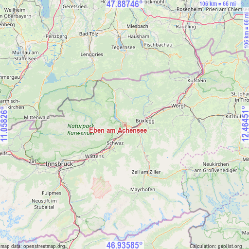
Eben am Achensee GPS coordinates[2]
47° 24' 49.68" North, 11° 45' 40.968" East
| Map corner | latitude | longitude |
|---|---|---|
| Upper-left | 47.88746°, | 11.05826° |
| Center: | 47.4138°, | 11.76138° |
| Lower-right: | 46.93585°, | 12.46451° |
| Map W x H: | 105.8×105.8 km | = 65.7×65.7mi |
| max Lat: | 48.98333° ⇑58.8% North |
| Eben am Achensee: | 47.4138° |
| min Lat: | ⇓41.2% South 46.48841° |
| min Long | Eben am Achense | max Long |
| 9.57802° | 11.76138° | 17.1° |
| W 9.7%⇐ | ⇒90.3% E |
Elevation
Elevation of Eben am Achensee is 959 m = 3146 ft, and this is 453.5 m = 1488 ft above average elevation for this country.
| Max E: |
2140 m = 7021 ft | 7.1% |
| Eben am Achensee | 959 m 3146 ft | |
| Avg. | 505.5 m = 1658 ft | |
Min E: |
118 m = 387 ft | 92.9% |
See also: Austria elevation on elevation.city.
Geographical zone
Eben am Achensee is located in North temperate zone (between Tropic of Cancer and the Arctic Circle). Distance of this North polar circle is 2129.3 km =1323.1 mi to North.| Distance of | km | miles | from Eben am Achensee |
|---|---|---|---|
| North Pole | 4735.1 | 2942.3 | to North |
| Arctic Circle | 2129.3 | 1323.1 | to North |
| Tropic Cancer | 2666 | 1656.6 | to South |
| Equator | 5271.9 | 3275.8 | to South |


Nearby cities:
15 places around Eben am Achensee: (largest is in red/bold)
• Bruck am Ziller
7.3 km =4.5 mi,  111°
111°
• Buch in Tirol
4.4 km =2.7 mi,  187°
187°
• Fiecht
8.5 km =5.3 mi,  213°
213°
• Gallzein
5.1 km =3.2 mi,  171°
171°
• Jenbach
2.6 km =1.6 mi,  161°
161°
• Maurach
1 km =0.6 mi,  322°
322°
• Münster
5.5 km =3.4 mi,  80°
80°
• Pertisau
5.8 km =3.6 mi,  300°
300°
• Reith im Alpbachtal
8.8 km =5.5 mi,  87°
87°
• Rofansiedlung
3.2 km =2 mi,  97°
97°
• Schlitters
6.9 km =4.3 mi,  122°
122°
• Schwaz
7.9 km =4.9 mi, 209°
• Stans
6.2 km =3.9 mi, 212°
• Strass im Zillertal
4.8 km =3 mi, 114°
• Wiesing
2.9 km =1.8 mi, 110°
Sources, notices
• [Note1] Compared only with cities in Austria existing in our database
• [Src1] Map data: © OpenStreetMap contributors (CC-BY-SA)
• [Src2] Other city data from geonames.org with taken over terms of usage.
• [Src3] Geographical zone / Annual Mean Temperature by Robert A. Rohde @ Wikipedia
