Hinterglemm geodata
Hinterglemm (Salzburg) is a populated place; located in Austria in Europe/Vienna (GMT+2) time zone. With population of 1,104 people, there are 1156 cities with bigger population in this country. Compared to other cities in Austria, 61.2% of cities are located further ↑North; 85.7% of cities are located further →East and 95.8% of cities have lower elevation than Hinterglemm. Note1
Administrative division(s):
- Level 1: Salzburg
- Level 2: Politischer Bezirk Zell am See
- Level 3: Saalbach-Hinterglemm


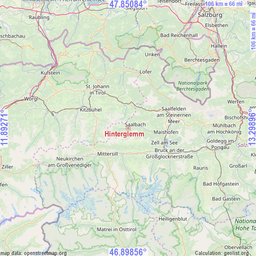
Hinterglemm GPS coordinates[2]
47° 22' 36.66" North, 12° 35' 44.988" East
| Map corner | latitude | longitude |
|---|---|---|
| Upper-left | 47.85084°, | 11.89271° |
| Center: | 47.37685°, | 12.59583° |
| Lower-right: | 46.89856°, | 13.29896° |
| Map W x H: | 105.9×105.9 km | = 65.8×65.8mi |
| max Lat: | 48.98333° ⇑61.2% North |
| Hinterglemm: | 47.37685° |
| min Lat: | ⇓38.8% South 46.48841° |
| min Long | Hinterglemm | max Long |
| 9.57802° | 12.59583° | 17.1° |
| W 14.3%⇐ | ⇒85.7% E |
Elevation
Elevation of Hinterglemm is 1063 m = 3488 ft, and this is 557.5 m = 1829 ft above average elevation for this country.
| Max E: |
2140 m = 7021 ft | 4.2% |
| Hinterglemm | 1063 m 3488 ft | |
| Avg. | 505.5 m = 1658 ft | |
Min E: |
118 m = 387 ft | 95.8% |
See also: Austria elevation on elevation.city.
Geographical zone
Hinterglemm is located in North temperate zone (between Tropic of Cancer and the Arctic Circle). Distance of this North polar circle is 2133.4 km =1325.6 mi to North.| Distance of | km | miles | from Hinterglemm |
|---|---|---|---|
| North Pole | 4739.3 | 2944.9 | to North |
| Arctic Circle | 2133.4 | 1325.6 | to North |
| Tropic Cancer | 2661.9 | 1654 | to South |
| Equator | 5267.8 | 3273.3 | to South |


Nearby cities:
15 places around Hinterglemm: (largest is in red/bold)
• Aurach
13.3 km =8.3 mi,  287°
287°
• Burk
12.5 km =7.8 mi,  217°
217°
• Felben
13.4 km =8.3 mi, 219°
• Fieberbrunn
11.7 km =7.3 mi,  340°
340°
• Hochfilzen
10.1 km =6.3 mi,  8°
8°
• Mittersill
13.4 km =8.3 mi, 219°
• Niedernsill
11.2 km =7 mi,  158°
158°
• Piesendorf
13.3 km =8.3 mi,  136°
136°
• Saalbach
3.5 km =2.2 mi,  62°
62°
• Sonnberg
13.2 km =8.2 mi,  51°
51°
• Steindorf
10.7 km =6.6 mi, 159°
• Stuhlfelden
11.2 km =7 mi,  207°
207°
• Uttendorf
10.6 km =6.6 mi,  191°
191°
• Viehhofen
10.4 km =6.5 mi,  96°
96°
• Walchen
12 km =7.5 mi,  145°
145°
Sources, notices
• [Note1] Compared only with cities in Austria existing in our database
• [Src1] Map data: © OpenStreetMap contributors (CC-BY-SA)
• [Src2] Other city data from geonames.org with taken over terms of usage.
• [Src3] Geographical zone / Annual Mean Temperature by Robert A. Rohde @ Wikipedia
