Hochfilzen geodata
Hochfilzen (Tyrol) is a seat of a third-order administrative division; located in Austria in Europe/Vienna (GMT+2) time zone. With population of 1,196 people, there are 1049 cities with bigger population in this country. Compared to other cities in Austria, 55.8% of cities are located further ↑North; 85.6% of cities are located further →East and 94.5% of cities have lower elevation than Hochfilzen. Note1
Administrative division(s):
- Level 1: Tyrol
- Level 2: Politischer Bezirk Kitzbühel
- Level 3: Hochfilzen


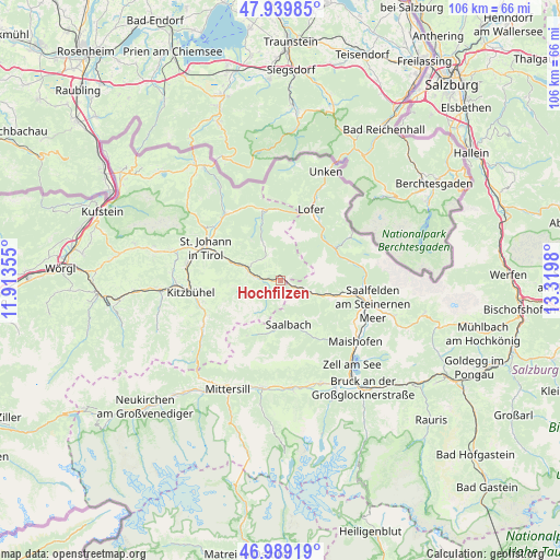
Hochfilzen GPS coordinates[2]
47° 28' 0.012" North, 12° 37' 0.012" East
| Map corner | latitude | longitude |
|---|---|---|
| Upper-left | 47.93985°, | 11.91355° |
| Center: | 47.46667°, | 12.61667° |
| Lower-right: | 46.98919°, | 13.3198° |
| Map W x H: | 105.7×105.7 km | = 65.7×65.7mi |
| max Lat: | 48.98333° ⇑55.8% North |
| Hochfilzen: | 47.46667° |
| min Lat: | ⇓44.2% South 46.48841° |
| min Long | Hochfilzen | max Long |
| 9.57802° | 12.61667° | 17.1° |
| W 14.4%⇐ | ⇒85.6% E |
Elevation
Elevation of Hochfilzen is 1000 m = 3281 ft, and this is 494.5 m = 1622 ft above average elevation for this country.
| Max E: |
2140 m = 7021 ft | 5.5% |
| Hochfilzen | 1000 m 3281 ft | |
| Avg. | 505.5 m = 1658 ft | |
Min E: |
118 m = 387 ft | 94.5% |
See also: Austria elevation on elevation.city.
Geographical zone
Hochfilzen is located in North temperate zone (between Tropic of Cancer and the Arctic Circle). Distance of this North polar circle is 2123.4 km =1319.4 mi to North.| Distance of | km | miles | from Hochfilzen |
|---|---|---|---|
| North Pole | 4729.3 | 2938.6 | to North |
| Arctic Circle | 2123.4 | 1319.4 | to North |
| Tropic Cancer | 2671.9 | 1660.2 | to South |
| Equator | 5277.8 | 3279.5 | to South |


Nearby cities:
15 places around Hochfilzen: (largest is in red/bold)
• Aurach
15.5 km =9.6 mi,  246°
246°
• Fieberbrunn
5.6 km =3.5 mi,  280°
280°
• Hinterglemm
10.1 km =6.3 mi,  188°
188°
• Kirchdorf in Tirol
16.3 km =10.1 mi,  307°
307°
• Lenzing
15.1 km =9.4 mi,  98°
98°
• Leogang
11.3 km =7 mi,  105°
105°
• Lofer
14.3 km =8.9 mi,  23°
23°
• Saalbach
8.5 km =5.3 mi,  169°
169°
• Sankt Jakob in Haus
6.2 km =3.9 mi, 306°
• Sankt Johann in Tirol
15.8 km =9.8 mi,  293°
293°
• Sankt Martin bei Lofer
12.8 km =8 mi,  29°
29°
• Sankt Ulrich am Pillersee
7.5 km =4.7 mi,  333°
333°
• Sonnberg
9 km =5.6 mi, 101°
• Viehhofen
14.2 km =8.8 mi,  141°
141°
• Waidring
13.5 km =8.4 mi,  343°
343°
Sources, notices
• [Note1] Compared only with cities in Austria existing in our database
• [Src1] Map data: © OpenStreetMap contributors (CC-BY-SA)
• [Src2] Other city data from geonames.org with taken over terms of usage.
• [Src3] Geographical zone / Annual Mean Temperature by Robert A. Rohde @ Wikipedia
