Liebenfels geodata
Liebenfels (Carinthia) is a seat of a third-order administrative division; located in Austria in Europe/Vienna (GMT+2) time zone. With population of 750 people, there are 1723 cities with bigger population in this country. Compared to other cities in Austria, 94% of cities are located further ↑North; 58.2% of cities are located further →East and 55.7% of cities have lower elevation than Liebenfels. Note1
Administrative division(s):
- Level 1: Carinthia
- Level 2: Politischer Bezirk Sankt Veit an der Glan
- Level 3: Liebenfels


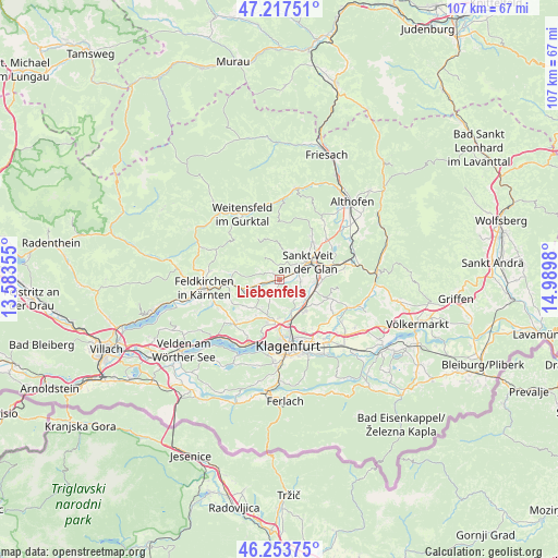
Liebenfels GPS coordinates[2]
46° 44' 16.008" North, 14° 17' 12.012" East
| Map corner | latitude | longitude |
|---|---|---|
| Upper-left | 47.21751°, | 13.58355° |
| Center: | 46.73778°, | 14.28667° |
| Lower-right: | 46.25375°, | 14.9898° |
| Map W x H: | 107.2×107.2 km | = 66.6×66.6mi |
| max Lat: | 48.98333° ⇑94% North |
| Liebenfels: | 46.73778° |
| min Lat: | ⇓6% South 46.48841° |
| min Long | Liebenfels | max Long |
| 9.57802° | 14.28667° | 17.1° |
| W 41.8%⇐ | ⇒58.2% E |
Elevation
Elevation of Liebenfels is 490 m = 1608 ft, and this is 15.5 m = 51 ft below average elevation for this country.
| Max E: |
2140 m = 7021 ft | 44.3% |
| Avg. | 505.5 m = 1658 ft | |
| Liebenfels | 490 m = 1608 ft | |
Min E: |
118 m = 387 ft | 55.7% |
See also: Austria elevation on elevation.city.
Geographical zone
Liebenfels is located in North temperate zone (between Tropic of Cancer and the Arctic Circle). Distance of this North polar circle is 2204.4 km =1369.8 mi to North.| Distance of | km | miles | from Liebenfels |
|---|---|---|---|
| North Pole | 4810.3 | 2989 | to North |
| Arctic Circle | 2204.4 | 1369.8 | to North |
| Tropic Cancer | 2590.8 | 1609.8 | to South |
| Equator | 5196.8 | 3229.1 | to South |


Nearby cities:
15 places around Liebenfels: (largest is in red/bold)
• 2.Bezirk
12.6 km =7.8 mi,  172°
172°
• Annabichl
10 km =6.2 mi, 166°
• Frauenstein
8.5 km =5.3 mi,  3°
3°
• Glanegg
6.9 km =4.3 mi,  255°
255°
• Karnburg
6.2 km =3.9 mi,  159°
159°
• Kraig
10.4 km =6.5 mi,  36°
36°
• Maria Saal
7.9 km =4.9 mi,  143°
143°
• Mauer
4.4 km =2.7 mi,  274°
274°
• Mautbrücken
7.3 km =4.5 mi,  254°
254°
• Moosburg
12.4 km =7.7 mi,  223°
223°
• Sankt Peter
11.2 km =7 mi, 224°
• Sankt Veit an der Glan
6.5 km =4 mi,  59°
59°
• St. Georgen am Längsee
11.9 km =7.4 mi,  66°
66°
• St. Veiter Vorstadt
11.9 km =7.4 mi, 172°
• Wölfnitz
8.2 km =5.1 mi,  195°
195°
Sources, notices
• [Note1] Compared only with cities in Austria existing in our database
• [Src1] Map data: © OpenStreetMap contributors (CC-BY-SA)
• [Src2] Other city data from geonames.org with taken over terms of usage.
• [Src3] Geographical zone / Annual Mean Temperature by Robert A. Rohde @ Wikipedia
