Kraig geodata
Kraig (Carinthia) is a populated place; located in Austria in Europe/Vienna (GMT+2) time zone. With population of 583 people, there are 2196 cities with bigger population in this country. Compared to other cities in Austria, 91.4% of cities are located further ↑North; 56.2% of cities are located further →East and 72.7% of cities have lower elevation than Kraig. Note1
Administrative division(s):
- Level 1: Carinthia
- Level 2: Politischer Bezirk Sankt Veit an der Glan
- Level 3: Frauenstein


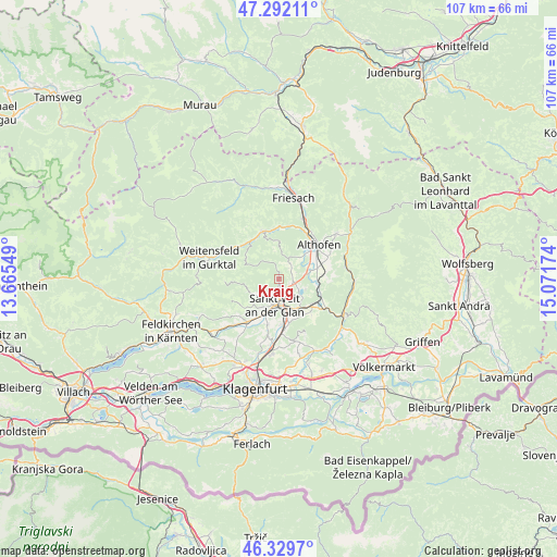
Kraig GPS coordinates[2]
46° 48' 47.016" North, 14° 22' 6.996" East
| Map corner | latitude | longitude |
|---|---|---|
| Upper-left | 47.29211°, | 13.66549° |
| Center: | 46.81306°, | 14.36861° |
| Lower-right: | 46.3297°, | 15.07174° |
| Map W x H: | 107×107 km | = 66.5×66.5mi |
| max Lat: | 48.98333° ⇑91.4% North |
| Kraig: | 46.81306° |
| min Lat: | ⇓8.6% South 46.48841° |
| min Long | Kraig | max Long |
| 9.57802° | 14.36861° | 17.1° |
| W 43.8%⇐ | ⇒56.2% E |
Elevation
Elevation of Kraig is 621 m = 2037 ft, and this is 115.5 m = 379 ft above average elevation for this country.
| Max E: |
2140 m = 7021 ft | 27.3% |
| Kraig | 621 m 2037 ft | |
| Avg. | 505.5 m = 1658 ft | |
Min E: |
118 m = 387 ft | 72.7% |
See also: Austria elevation on elevation.city.
Geographical zone
Kraig is located in North temperate zone (between Tropic of Cancer and the Arctic Circle). Distance of this North polar circle is 2196 km =1364.5 mi to North.| Distance of | km | miles | from Kraig |
|---|---|---|---|
| North Pole | 4801.9 | 2983.8 | to North |
| Arctic Circle | 2196 | 1364.5 | to North |
| Tropic Cancer | 2599.2 | 1615.1 | to South |
| Equator | 5205.1 | 3234.3 | to South |


Nearby cities:
15 places around Kraig: (largest is in red/bold)
• Althofen
10.5 km =6.5 mi,  50°
50°
• Frauenstein
5.7 km =3.5 mi,  271°
271°
• Gurk
8.9 km =5.5 mi,  319°
319°
• Kappel am Krappfeld
9.4 km =5.8 mi,  72°
72°
• Klein Sankt Paul
13.4 km =8.3 mi,  78°
78°
• Launsdorf
7.9 km =4.9 mi,  126°
126°
• Liebenfels
10.4 km =6.5 mi,  216°
216°
• Mauer
13.3 km =8.3 mi,  232°
232°
• Micheldorf
12.1 km =7.5 mi,  17°
17°
• Micheldorf in Kärnten
12.1 km =7.5 mi, 21°
• Mölbling
6.4 km =4 mi, 50°
• Sankt Veit an der Glan
5 km =3.1 mi,  187°
187°
• St. Georgen am Längsee
5.9 km =3.7 mi, 127°
• Straßburg-Stadt
9.5 km =5.9 mi,  341°
341°
• Treibach
9.5 km =5.9 mi, 51°
Sources, notices
• [Note1] Compared only with cities in Austria existing in our database
• [Src1] Map data: © OpenStreetMap contributors (CC-BY-SA)
• [Src2] Other city data from geonames.org with taken over terms of usage.
• [Src3] Geographical zone / Annual Mean Temperature by Robert A. Rohde @ Wikipedia
