Ursprung geodata
Ursprung (Styria) is a populated place; located in Austria in Europe/Vienna (GMT+2) time zone. With population of 576 people, there are 2225 cities with bigger population in this country. Compared to other cities in Austria, 77.2% of cities are located further ↑North; 63.6% of cities are located further ←West and 57.5% of cities have lower elevation than Ursprung. Note1
Administrative division(s):
- Level 1: Styria
- Level 2: Politischer Bezirk Graz-Umgebung
- Level 3: Stattegg


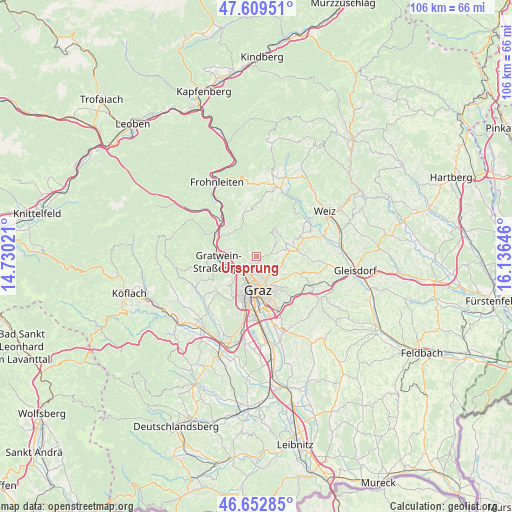
Ursprung GPS coordinates[2]
47° 7' 59.988" North, 15° 25' 59.988" East
| Map corner | latitude | longitude |
|---|---|---|
| Upper-left | 47.60951°, | 14.73021° |
| Center: | 47.13333°, | 15.43333° |
| Lower-right: | 46.65285°, | 16.13646° |
| Map W x H: | 106.4×106.4 km | = 66.1×66.1mi |
| max Lat: | 48.98333° ⇑77.2% North |
| Ursprung: | 47.13333° |
| min Lat: | ⇓22.8% South 46.48841° |
| min Long | Ursprung | max Long |
| 9.57802° | 15.43333° | 17.1° |
| W 63.6%⇐ | ⇒36.4% E |
Elevation
Elevation of Ursprung is 501 m = 1644 ft, and this is 4.5 m = 15 ft below average elevation for this country.
| Max E: |
2140 m = 7021 ft | 42.5% |
| Avg. | 505.5 m = 1658 ft | |
| Ursprung | 501 m = 1644 ft | |
Min E: |
118 m = 387 ft | 57.5% |
See also: Austria elevation on elevation.city.
Geographical zone
Ursprung is located in North temperate zone (between Tropic of Cancer and the Arctic Circle). Distance of this North polar circle is 2160.4 km =1342.4 mi to North.| Distance of | km | miles | from Ursprung |
|---|---|---|---|
| North Pole | 4766.3 | 2961.6 | to North |
| Arctic Circle | 2160.4 | 1342.4 | to North |
| Tropic Cancer | 2634.8 | 1637.2 | to South |
| Equator | 5240.7 | 3256.4 | to South |


Nearby cities:
15 places around Ursprung: (largest is in red/bold)
• Andritz
2.3 km =1.4 mi,  199°
199°
• Freßnitzviertel
5.3 km =3.3 mi,  314°
314°
• Geidorf
5.6 km =3.5 mi,  171°
171°
• Gratkorn
6.3 km =3.9 mi,  270°
270°
• Gösting
4.8 km =3 mi,  214°
214°
• Hub
2.2 km =1.4 mi,  325°
325°
• Höf
4.4 km =2.7 mi,  89°
89°
• Kirchenviertel
6.5 km =4 mi, 267°
• Lend
5.8 km =3.6 mi,  193°
193°
• Mariatrost
6.3 km =3.9 mi,  126°
126°
• Niederschöckl
5.4 km =3.4 mi,  69°
69°
• Oberschöckl
4.2 km =2.6 mi,  63°
63°
• Rabnitz
6.6 km =4.1 mi, 73°
• Rinnegg
5.2 km =3.2 mi,  52°
52°
• Stattegg
1.3 km =0.8 mi, 270°
Sources, notices
• [Note1] Compared only with cities in Austria existing in our database
• [Src1] Map data: © OpenStreetMap contributors (CC-BY-SA)
• [Src2] Other city data from geonames.org with taken over terms of usage.
• [Src3] Geographical zone / Annual Mean Temperature by Robert A. Rohde @ Wikipedia
