Höf geodata
Höf (Styria) is a populated place; located in Austria in Europe/Vienna (GMT+2) time zone. With population of 1,027 people, there are 1249 cities with bigger population in this country. Compared to other cities in Austria, 76.8% of cities are located further ↑North; 65.3% of cities are located further ←West and 50.9% of cities have lower elevation than Höf. Note1
Administrative division(s):
- Level 1: Styria
- Level 2: Politischer Bezirk Graz-Umgebung
- Level 3: Eggersdorf bei Graz


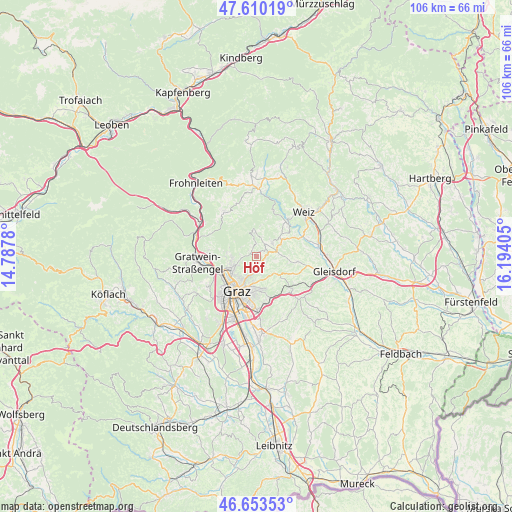
Höf GPS coordinates[2]
47° 8' 2.436" North, 15° 29' 27.312" East
| Map corner | latitude | longitude |
|---|---|---|
| Upper-left | 47.61019°, | 14.7878° |
| Center: | 47.13401°, | 15.49092° |
| Lower-right: | 46.65353°, | 16.19405° |
| Map W x H: | 106.4×106.4 km | = 66.1×66.1mi |
| max Lat: | 48.98333° ⇑76.8% North |
| Höf: | 47.13401° |
| min Lat: | ⇓23.2% South 46.48841° |
| min Long | Höf | max Long |
| 9.57802° | 15.49092° | 17.1° |
| W 65.3%⇐ | ⇒34.7% E |
Elevation
Elevation of Höf is 456 m = 1496 ft, and this is 49.5 m = 162 ft below average elevation for this country.
| Max E: |
2140 m = 7021 ft | 49.1% |
| Avg. | 505.5 m = 1658 ft | |
| Höf | 456 m = 1496 ft | |
Min E: |
118 m = 387 ft | 50.9% |
See also: Austria elevation on elevation.city.
Geographical zone
Höf is located in North temperate zone (between Tropic of Cancer and the Arctic Circle). Distance of this North polar circle is 2160.4 km =1342.4 mi to North.| Distance of | km | miles | from Höf |
|---|---|---|---|
| North Pole | 4766.3 | 2961.6 | to North |
| Arctic Circle | 2160.4 | 1342.4 | to North |
| Tropic Cancer | 2634.9 | 1637.3 | to South |
| Equator | 5240.8 | 3256.5 | to South |


Nearby cities:
15 places around Höf: (largest is in red/bold)
• Andritz
5.6 km =3.5 mi,  246°
246°
• Hart bei Eggersdorf
5.7 km =3.5 mi,  90°
90°
• Hub
5.9 km =3.7 mi,  287°
287°
• Kainbach
6 km =3.7 mi,  160°
160°
• Kumberg
4.6 km =2.9 mi,  43°
43°
• Mariatrost
3.8 km =2.4 mi,  169°
169°
• Niederschöckl
1.9 km =1.2 mi,  21°
21°
• Oberschöckl
1.9 km =1.2 mi,  342°
342°
• Purgstall
6 km =3.7 mi,  108°
108°
• Rabnitz
2.6 km =1.6 mi,  47°
47°
• Ries
5.7 km =3.5 mi,  184°
184°
• Rinnegg
3.1 km =1.9 mi,  356°
356°
• Sankt Radegund bei Graz
5.3 km =3.3 mi,  0°
0°
• Stattegg
5.6 km =3.5 mi,  269°
269°
• Ursprung
4.4 km =2.7 mi, 269°
Sources, notices
• [Note1] Compared only with cities in Austria existing in our database
• [Src1] Map data: © OpenStreetMap contributors (CC-BY-SA)
• [Src2] Other city data from geonames.org with taken over terms of usage.
• [Src3] Geographical zone / Annual Mean Temperature by Robert A. Rohde @ Wikipedia
