Forstviertel geodata
Forstviertel (Styria) is a populated place; located in Austria in Europe/Vienna (GMT+2) time zone. With population of 540 people, there are 2360 cities with bigger population in this country. Compared to other cities in Austria, 76% of cities are located further ↑North; 61.6% of cities are located further ←West and 51.7% of cities have lower elevation than Forstviertel. Note1
Administrative division(s):
- Level 1: Styria
- Level 2: Politischer Bezirk Graz-Umgebung
- Level 3: Gratkorn


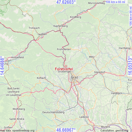
Forstviertel GPS coordinates[2]
47° 9' 0" North, 15° 21' 0" East
| Map corner | latitude | longitude |
|---|---|---|
| Upper-left | 47.62603°, | 14.64688° |
| Center: | 47.15°, | 15.35° |
| Lower-right: | 46.66967°, | 16.05313° |
| Map W x H: | 106.3×106.3 km | = 66.1×66.1mi |
| max Lat: | 48.98333° ⇑76% North |
| Forstviertel: | 47.15° |
| min Lat: | ⇓24% South 46.48841° |
| min Long | Forstviertel | max Long |
| 9.57802° | 15.35° | 17.1° |
| W 61.6%⇐ | ⇒38.4% E |
Elevation
Elevation of Forstviertel is 461 m = 1512 ft, and this is 44.5 m = 146 ft below average elevation for this country.
| Max E: |
2140 m = 7021 ft | 48.3% |
| Avg. | 505.5 m = 1658 ft | |
| Forstviertel | 461 m = 1512 ft | |
Min E: |
118 m = 387 ft | 51.7% |
See also: Austria elevation on elevation.city.
Geographical zone
Forstviertel is located in North temperate zone (between Tropic of Cancer and the Arctic Circle). Distance of this North polar circle is 2158.6 km =1341.3 mi to North.| Distance of | km | miles | from Forstviertel |
|---|---|---|---|
| North Pole | 4764.5 | 2960.5 | to North |
| Arctic Circle | 2158.6 | 1341.3 | to North |
| Tropic Cancer | 2636.7 | 1638.4 | to South |
| Equator | 5242.6 | 3257.6 | to South |


Nearby cities:
15 places around Forstviertel: (largest is in red/bold)
• Deutschfeistritz
5.5 km =3.4 mi,  349°
349°
• Freßnitzviertel
3.1 km =1.9 mi,  53°
53°
• Gratkorn
1.9 km =1.2 mi,  180°
180°
• Gratwein
4.5 km =2.8 mi,  214°
214°
• Hub
5 km =3.1 mi,  90°
90°
• Hörgas
3.8 km =2.4 mi,  270°
270°
• Judendorf
3.7 km =2.3 mi, 180°
• Kirchenviertel
2.1 km =1.3 mi, 184°
• Kleinstübing
4.5 km =2.8 mi,  325°
325°
• Peggau
5.6 km =3.5 mi,  0°
0°
• Rein
5.4 km =3.4 mi,  249°
249°
• Rötz
4.5 km =2.8 mi, 214°
• Stattegg
5.4 km =3.4 mi,  110°
110°
• Strassengel
4 km =2.5 mi,  198°
198°
• Ursprung
6.6 km =4.1 mi, 106°
Sources, notices
• [Note1] Compared only with cities in Austria existing in our database
• [Src1] Map data: © OpenStreetMap contributors (CC-BY-SA)
• [Src2] Other city data from geonames.org with taken over terms of usage.
• [Src3] Geographical zone / Annual Mean Temperature by Robert A. Rohde @ Wikipedia
