Nebelberg geodata
Nebelberg (Upper Austria) is a seat of a third-order administrative division; located in Austria in Europe/Vienna (GMT+2) time zone. With population of 144 people, there are 2900 cities with bigger population in this country. Compared to other cities in Austria, 97.1% of cities are located further ↓South; 68.1% of cities are located further →East and 78.4% of cities have lower elevation than Nebelberg. Note1
Administrative division(s):
- Level 1: Upper Austria
- Level 2: Politischer Bezirk Rohrbach
- Level 3: Nebelberg


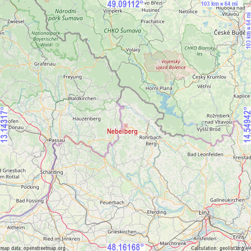
Nebelberg GPS coordinates[2]
48° 37' 42.744" North, 13° 50' 46.644" East
| Map corner | latitude | longitude |
|---|---|---|
| Upper-left | 49.09112°, | 13.14317° |
| Center: | 48.62854°, | 13.84629° |
| Lower-right: | 48.16168°, | 14.54942° |
| Map W x H: | 103.3×103.3 km | = 64.2×64.2mi |
| max Lat: | 48.98333° ⇑2.9% North |
| Nebelberg: | 48.62854° |
| min Lat: | ⇓97.1% South 46.48841° |
| min Long | Nebelberg | max Long |
| 9.57802° | 13.84629° | 17.1° |
| W 31.9%⇐ | ⇒68.1% E |
Elevation
Elevation of Nebelberg is 694 m = 2277 ft, and this is 188.5 m = 618 ft above average elevation for this country.
| Max E: |
2140 m = 7021 ft | 21.6% |
| Nebelberg | 694 m 2277 ft | |
| Avg. | 505.5 m = 1658 ft | |
Min E: |
118 m = 387 ft | 78.4% |
See also: Austria elevation on elevation.city.
Geographical zone
Nebelberg is located in North temperate zone (between Tropic of Cancer and the Arctic Circle). Distance of this North polar circle is 1994.2 km =1239.1 mi to North.| Distance of | km | miles | from Nebelberg |
|---|---|---|---|
| North Pole | 4600.1 | 2858.4 | to North |
| Arctic Circle | 1994.2 | 1239.1 | to North |
| Tropic Cancer | 2801.1 | 1740.5 | to South |
| Equator | 5407 | 3359.8 | to South |


Nearby cities:
15 places around Nebelberg: (largest is in red/bold)
• Aigen im Mühlkreis
9.4 km =5.8 mi,  78°
78°
• Atzesberg
10 km =6.2 mi,  170°
170°
• Berg bei Rohrbach
12 km =7.5 mi,  117°
117°
• Haslach an der Mühl
15.4 km =9.6 mi,  112°
112°
• Julbach
3.9 km =2.4 mi,  21°
21°
• Klaffer am Hochficht
7.9 km =4.9 mi, 19°
• Kollerschlag
2.6 km =1.6 mi,  188°
188°
• Lembach im Mühlkreis
15.3 km =9.5 mi, 166°
• Neustift im Mühlkreis
12.9 km =8 mi,  210°
210°
• Oepping
7.9 km =4.9 mi, 111°
• Peilstein im Mühlviertel
3.8 km =2.4 mi, 109°
• Putzleinsdorf
12.7 km =7.9 mi, 171°
• Rohrbach in Oberösterreich
12.1 km =7.5 mi, 120°
• Sarleinsbach
10.2 km =6.3 mi,  155°
155°
• Ulrichsberg
7 km =4.3 mi,  42°
42°
Sources, notices
• [Note1] Compared only with cities in Austria existing in our database
• [Src1] Map data: © OpenStreetMap contributors (CC-BY-SA)
• [Src2] Other city data from geonames.org with taken over terms of usage.
• [Src3] Geographical zone / Annual Mean Temperature by Robert A. Rohde @ Wikipedia
