Atzesberg geodata
Atzesberg (Upper Austria) is a seat of a third-order administrative division; located in Austria in Europe/Vienna (GMT+2) time zone. With population of 57 people, there are 2939 cities with bigger population in this country. Compared to other cities in Austria, 95.3% of cities are located further ↓South; 67.5% of cities are located further →East and 76.8% of cities have lower elevation than Atzesberg. Note1
Administrative division(s):
- Level 1: Upper Austria
- Level 2: Politischer Bezirk Rohrbach
- Level 3: Atzesberg


Atzesberg GPS coordinates[2]
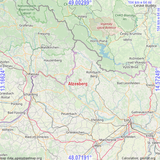
48° 32' 22.524" North, 13° 52' 9.696" East
| Map corner | latitude | longitude |
|---|---|---|
| Upper-left | 49.00299°, | 13.16624° |
| Center: | 48.53959°, | 13.86936° |
| Lower-right: | 48.07191°, | 14.57249° |
| Map W x H: | 103.5×103.5 km | = 64.3×64.3mi |
| max Lat: | 48.98333° ⇑4.7% North |
| Atzesberg: | 48.53959° |
| min Lat: | ⇓95.3% South 46.48841° |
| min Long | Atzesberg | max Long |
| 9.57802° | 13.86936° | 17.1° |
| W 32.5%⇐ | ⇒67.5% E |
Elevation
Elevation of Atzesberg is 674 m = 2211 ft, and this is 168.5 m = 553 ft above average elevation for this country.
| Max E: |
2140 m = 7021 ft | 23.2% |
| Atzesberg | 674 m 2211 ft | |
| Avg. | 505.5 m = 1658 ft | |
Min E: |
118 m = 387 ft | 76.8% |
See also: Austria elevation on elevation.city.
Geographical zone
Atzesberg is located in North temperate zone (between Tropic of Cancer and the Arctic Circle). Distance of this North polar circle is 2004.1 km =1245.3 mi to North.| Distance of | km | miles | from Atzesberg |
|---|---|---|---|
| North Pole | 4610 | 2864.5 | to North |
| Arctic Circle | 2004.1 | 1245.3 | to North |
| Tropic Cancer | 2791.2 | 1734.4 | to South |
| Equator | 5397.1 | 3353.6 | to South |


Nearby cities:
15 places around Atzesberg: (largest is in red/bold)
• Altenfelden
9.5 km =5.9 mi,  129°
129°
• Arnreit
9.4 km =5.8 mi,  99°
99°
• Berg bei Rohrbach
9.9 km =6.2 mi,  64°
64°
• Hofkirchen im Mühlkreis
7.6 km =4.7 mi,  215°
215°
• Kollerschlag
7.6 km =4.7 mi,  343°
343°
• Lembach im Mühlkreis
5.3 km =3.3 mi,  158°
158°
• Nebelberg
10 km =6.2 mi,  350°
350°
• Neufelden
11.3 km =7 mi,  123°
123°
• Neustift im Mühlkreis
8.4 km =5.2 mi,  261°
261°
• Oepping
9 km =5.6 mi,  38°
38°
• Peilstein im Mühlviertel
8.9 km =5.5 mi,  12°
12°
• Putzleinsdorf
2.7 km =1.7 mi,  173°
173°
• Rohrbach in Oberösterreich
9.5 km =5.9 mi,  67°
67°
• Sarleinsbach
2.7 km =1.7 mi,  76°
76°
• Waldkirchen am Wesen
11.6 km =7.2 mi,  197°
197°
Sources, notices
• [Note1] Compared only with cities in Austria existing in our database
• [Src1] Map data: © OpenStreetMap contributors (CC-BY-SA)
• [Src2] Other city data from geonames.org with taken over terms of usage.
• [Src3] Geographical zone / Annual Mean Temperature by Robert A. Rohde @ Wikipedia
