Rohrbach in Oberösterreich geodata
Rohrbach in Oberösterreich (Upper Austria) is a populated place; located in Austria in Europe/Vienna (GMT+2) time zone. With population of 2,432 people, there are 490 cities with bigger population in this country. Compared to other cities in Austria, 96% of cities are located further ↓South; 65.2% of cities are located further →East and 70.6% of cities have lower elevation than Rohrbach in Oberösterreich. Note1
Administrative division(s):
- Level 1: Upper Austria
- Level 2: Politischer Bezirk Rohrbach
- Level 3: Rohrbach-Berg
Current local time in Rohrbach in Oberösterreich:
11:53 PM, FridayDifference from your time zone: hours


Rohrbach in Oberösterreich GPS coordinates[2]
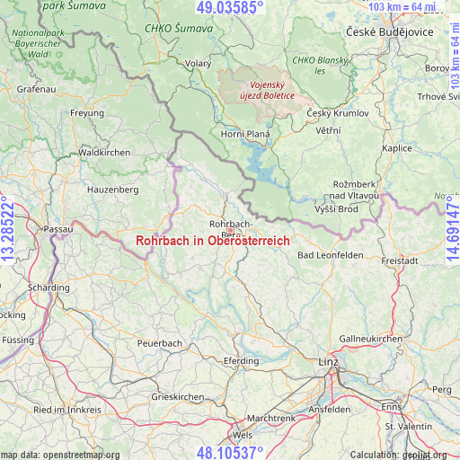
48° 34' 21.9" North, 13° 59' 18.024" East
| Map corner | latitude | longitude |
|---|---|---|
| Upper-left | 49.03585°, | 13.28522° |
| Center: | 48.57275°, | 13.98834° |
| Lower-right: | 48.10537°, | 14.69147° |
| Map W x H: | 103.5×103.5 km | = 64.3×64.3mi |
| max Lat: | 48.98333° ⇑4% North |
| Rohrbach in Oberösterreich: | 48.57275° |
| min Lat: | ⇓96% South 46.48841° |
| min Long | Rohrbach in Obe | max Long |
| 9.57802° | 13.98834° | 17.1° |
| W 34.8%⇐ | ⇒65.2% E |
Elevation
Elevation of Rohrbach in Oberösterreich is 596 m = 1955 ft, and this is 90.5 m = 297 ft above average elevation for this country.
| Max E: |
2140 m = 7021 ft | 29.4% |
| Rohrbach in Oberösterreich | 596 m 1955 ft | |
| Avg. | 505.5 m = 1658 ft | |
Min E: |
118 m = 387 ft | 70.6% |
See also: Austria elevation on elevation.city.
Geographical zone
Rohrbach in Oberösterreich is located in North temperate zone (between Tropic of Cancer and the Arctic Circle). Distance of this North polar circle is 2000.4 km =1243 mi to North.| Distance of | km | miles | from Rohrbach in Oberösterreich |
|---|---|---|---|
| North Pole | 4606.3 | 2862.2 | to North |
| Arctic Circle | 2000.4 | 1243 | to North |
| Tropic Cancer | 2794.9 | 1736.7 | to South |
| Equator | 5400.8 | 3355.9 | to South |


Nearby cities:
15 places around Rohrbach in Oberösterreich: (largest is in red/bold)
• Afiesl
10.3 km =6.4 mi,  84°
84°
• Aigen im Mühlkreis
8.2 km =5.1 mi,  351°
351°
• Altenfelden
9.8 km =6.1 mi,  188°
188°
• Arnreit
5.3 km =3.3 mi,  174°
174°
• Atzesberg
9.5 km =5.9 mi,  247°
247°
• Berg bei Rohrbach
0.6 km =0.4 mi,  20°
20°
• Haslach an der Mühl
3.8 km =2.4 mi,  85°
85°
• Kollerschlag
11.4 km =7.1 mi,  288°
288°
• Lembach im Mühlkreis
11 km =6.8 mi,  218°
218°
• Neufelden
10 km =6.2 mi,  176°
176°
• Oepping
4.6 km =2.9 mi,  316°
316°
• Peilstein im Mühlviertel
8.5 km =5.3 mi,  305°
305°
• Putzleinsdorf
10.6 km =6.6 mi,  233°
233°
• Sankt Peter am Wimberg
10.3 km =6.4 mi,  139°
139°
• Sarleinsbach
6.9 km =4.3 mi,  243°
243°
In other languages:
- In Russian: Рорбах (Верхняя Австрия), Рорбах-ин-Оберэстеррайх
- In Chinese: 上奥地利州罗尔巴赫
Sources, notices
• [Note1] Compared only with cities in Austria existing in our database
• [Src1] Map data: © OpenStreetMap contributors (CC-BY-SA)
• [Src2] Other city data from geonames.org with taken over terms of usage.
• [Src3] Geographical zone / Annual Mean Temperature by Robert A. Rohde @ Wikipedia
