Tux geodata
Tux (Tyrol) is a seat of a third-order administrative division; located in Austria in Europe/Vienna (GMT+2) time zone. With population of 1,941 people, there are 635 cities with bigger population in this country. Compared to other cities in Austria, 75.3% of cities are located further ↑North; 90.4% of cities are located further →East and 99.7% of cities have lower elevation than Tux. Note1


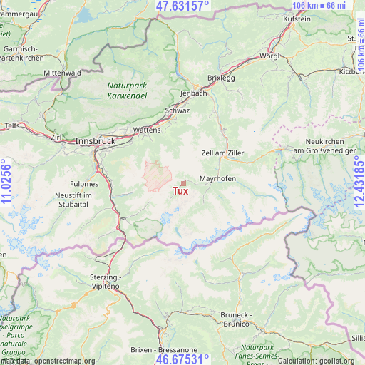
Tux GPS coordinates[2]
47° 9' 20.124" North, 11° 43' 43.392" East
| Map corner | latitude | longitude |
|---|---|---|
| Upper-left | 47.63157°, | 11.0256° |
| Center: | 47.15559°, | 11.72872° |
| Lower-right: | 46.67531°, | 12.43185° |
| Map W x H: | 106.3×106.3 km | = 66.1×66.1mi |
| max Lat: | 48.98333° ⇑75.3% North |
| Tux: | 47.15559° |
| min Lat: | ⇓24.7% South 46.48841° |
| min Long | Tux | max Long |
| 9.57802° | 11.72872° | 17.1° |
| W 9.6%⇐ | ⇒90.4% E |
Elevation
Elevation of Tux is 1520 m = 4987 ft, and this is 1014.5 m = 3328 ft above average elevation for this country.
| Max E: |
2140 m = 7021 ft | 0.3% |
| Tux | 1520 m 4987 ft | |
| Avg. | 505.5 m = 1658 ft | |
Min E: |
118 m = 387 ft | 99.7% |
See also: Austria elevation on elevation.city.
Geographical zone
Tux is located in North temperate zone (between Tropic of Cancer and the Arctic Circle). Distance of this North polar circle is 2158 km =1340.9 mi to North.| Distance of | km | miles | from Tux |
|---|---|---|---|
| North Pole | 4763.9 | 2960.1 | to North |
| Arctic Circle | 2158 | 1340.9 | to North |
| Tropic Cancer | 2637.3 | 1638.7 | to South |
| Equator | 5243.2 | 3258 | to South |


Nearby cities:
15 places around Tux: (largest is in red/bold)
• Finkenberg
7.1 km =4.4 mi,  92°
92°
• Hainzenberg
14.7 km =9.1 mi,  61°
61°
• Hippach
11.7 km =7.3 mi, 62°
• Hippach-Schwendberg
10.6 km =6.6 mi, 60°
• Kolsassberg
15.1 km =9.4 mi,  337°
337°
• Laimach
12.4 km =7.7 mi, 56°
• Mayrhofen
10.5 km =6.5 mi,  83°
83°
• Oberweg
16.2 km =10.1 mi,  261°
261°
• Ramsau im Zillertal
12.3 km =7.6 mi, 64°
• Rohrberg
16.6 km =10.3 mi, 58°
• Schmirn
14.7 km =9.1 mi,  236°
236°
• Schwendau
10.9 km =6.8 mi, 64°
• Weerberg
16.6 km =10.3 mi, 343°
• Zell am Ziller
14.5 km =9 mi,  53°
53°
• Zellberg
12.6 km =7.8 mi, 46°
Sources, notices
• [Note1] Compared only with cities in Austria existing in our database
• [Src1] Map data: © OpenStreetMap contributors (CC-BY-SA)
• [Src2] Other city data from geonames.org with taken over terms of usage.
• [Src3] Geographical zone / Annual Mean Temperature by Robert A. Rohde @ Wikipedia
