Zeil-Pöllau geodata
Zeil-Pöllau (Styria) is a populated place; located in Austria in Europe/Vienna (GMT+2) time zone. With population of 744 people, there are 1739 cities with bigger population in this country. Compared to other cities in Austria, 63.8% of cities are located further ↑North; 75.8% of cities are located further ←West and 66.9% of cities have lower elevation than Zeil-Pöllau. Note1
Administrative division(s):
- Level 1: Styria
- Level 2: Politischer Bezirk Hartberg-Fürstenfeld
- Level 3: Pöllauberg


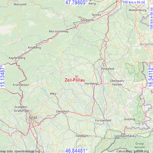
Zeil-Pöllau GPS coordinates[2]
47° 19' 24.888" North, 15° 50' 16.764" East
| Map corner | latitude | longitude |
|---|---|---|
| Upper-left | 47.79805°, | 15.13487° |
| Center: | 47.32358°, | 15.83799° |
| Lower-right: | 46.84481°, | 16.54112° |
| Map W x H: | 106×106 km | = 65.9×65.9mi |
| max Lat: | 48.98333° ⇑63.8% North |
| Zeil-Pöllau: | 47.32358° |
| min Lat: | ⇓36.2% South 46.48841° |
| min Long | Zeil-Pöllau | max Long |
| 9.57802° | 15.83799° | 17.1° |
| W 75.8%⇐ | ⇒24.2% E |
Elevation
Elevation of Zeil-Pöllau is 565 m = 1854 ft, and this is 59.5 m = 195 ft above average elevation for this country.
| Max E: |
2140 m = 7021 ft | 33.1% |
| Zeil-Pöllau | 565 m 1854 ft | |
| Avg. | 505.5 m = 1658 ft | |
Min E: |
118 m = 387 ft | 66.9% |
See also: Austria elevation on elevation.city.
Geographical zone
Zeil-Pöllau is located in North temperate zone (between Tropic of Cancer and the Arctic Circle). Distance of this North polar circle is 2139.3 km =1329.3 mi to North.| Distance of | km | miles | from Zeil-Pöllau |
|---|---|---|---|
| North Pole | 4745.2 | 2948.5 | to North |
| Arctic Circle | 2139.3 | 1329.3 | to North |
| Tropic Cancer | 2656 | 1650.4 | to South |
| Equator | 5261.9 | 3269.6 | to South |


Nearby cities:
15 places around Zeil-Pöllau: (largest is in red/bold)
• Flattendorf
8.7 km =5.4 mi,  136°
136°
• Löffelbach
8.5 km =5.3 mi,  121°
121°
• Miesenbach bei Birkfeld
7.2 km =4.5 mi,  311°
311°
• Oberneuberg
2.3 km =1.4 mi,  109°
109°
• Obersaifen
4.2 km =2.6 mi,  259°
259°
• Pongrazen bei Hartberg
5.8 km =3.6 mi,  69°
69°
• Prätis
3.2 km =2 mi,  321°
321°
• Puchegg
7.5 km =4.7 mi,  31°
31°
• Pöllau
2.6 km =1.6 mi,  187°
187°
• Pöllauberg
1.2 km =0.7 mi,  130°
130°
• Schachen bei Vorau
6.5 km =4 mi,  13°
13°
• Stambach
7.3 km =4.5 mi,  81°
81°
• Staudach
8.3 km =5.2 mi,  97°
97°
• Unterneuberg
1.2 km =0.7 mi, 130°
• Vornholz
8.2 km =5.1 mi,  353°
353°
Sources, notices
• [Note1] Compared only with cities in Austria existing in our database
• [Src1] Map data: © OpenStreetMap contributors (CC-BY-SA)
• [Src2] Other city data from geonames.org with taken over terms of usage.
• [Src3] Geographical zone / Annual Mean Temperature by Robert A. Rohde @ Wikipedia
