Wyreema geodata
Wyreema (Queensland) is a populated place; located in Australia in Australia/Brisbane (GMT+10) time zone. With population of 1,778 people, there are 3067 cities with bigger population in this country. Compared to other cities in Australia, 78.3% of cities are located further ↓South; 81.6% of cities are located further ←West and 93.9% of cities have lower elevation than Wyreema. Note1


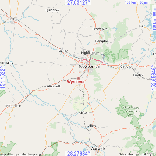
Wyreema GPS coordinates[2]
27° 39' 20.988" South, 151° 51' 19.152" East
| Map corner | latitude | longitude |
|---|---|---|
| Upper-left | -27.03127°, | 151.1522° |
| Center: | -27.65583°, | 151.85532° |
| Lower-right: | -28.27684°, | 152.55845° |
| Map W x H: | 138.5×138.5 km | = 86.1×86.1mi |
| max Lat: | -10.58257° ⇑21.7% North |
| Wyreema: | -27.65583° |
| min Lat: | ⇓78.3% South -43.31423° |
| min Long | Wyreema | max Long |
| 113.53327° | 151.85532° | 153.61246° |
| W 81.6%⇐ | ⇒18.4% E |
Elevation
Elevation of Wyreema is 536 m = 1759 ft, and this is 414 m = 1358 ft above average elevation for this country.
| Max E: |
1715 m = 5627 ft | 6.1% |
| Wyreema | 536 m 1759 ft | |
| Avg. | 122 m = 400 ft | |
Min E: |
-2 m = -7 ft | 93.9% |
See also: Australia elevation on elevation.city.
Geographical zone
Wyreema is located in South temperate zone (between Tropic of Capricorn and the Antarctic Circle). Distance of this Southern Tropic circle is 469.1 km =291.5 mi to North.| Distance of | km | miles | from Wyreema |
|---|---|---|---|
| Equator | 3075 | 1910.7 | to North |
| Tropic Capricorn | 469.1 | 291.5 | to North |
| Antarctic Circle | 4326.1 | 2688.1 | to South |
| South Pole | 6932 | 4307.3 | to South |


Nearby cities:
15 places around Wyreema: (largest is in red/bold)
• Cambooya
6.5 km =4 mi,  175°
175°
• Centenary Heights
13.1 km =8.1 mi,  53°
53°
• Darling Heights
9.9 km =6.2 mi, 48°
• Drayton
7.7 km =4.8 mi,  36°
36°
• Glenvale
10.4 km =6.5 mi,  21°
21°
• Harristown
11.1 km =6.9 mi, 43°
• Hodgson Vale
7.7 km =4.8 mi,  97°
97°
• Kearneys Spring
10.2 km =6.3 mi,  56°
56°
• Middle Ridge
12.3 km =7.6 mi, 63°
• Newtown
13.5 km =8.4 mi,  34°
34°
• Preston
12.9 km =8 mi,  92°
92°
• South Toowoomba
13 km =8.1 mi, 43°
• Top Camp
8.6 km =5.3 mi,  74°
74°
• Torrington
13 km =8.1 mi,  14°
14°
• Westbrook
4.5 km =2.8 mi, 14°
Sources, notices
• [Note1] Compared only with cities in Australia existing in our database
• [Src1] Map data: © OpenStreetMap contributors (CC-BY-SA)
• [Src2] Other city data from geonames.org with taken over terms of usage.
• [Src3] Geographical zone / Annual Mean Temperature by Robert A. Rohde @ Wikipedia
