Werribee South geodata
Werribee South (Victoria) is a section of populated place; located in Australia in Australia/Melbourne (GMT+11) time zone. With population of 1,788 people, there are 3058 cities with bigger population in this country. Compared to other cities in Australia, 91.2% of cities are located further ↑North; 69.5% of cities are located further →East and 91.8% of cities have higher elevation than Werribee South. Note1


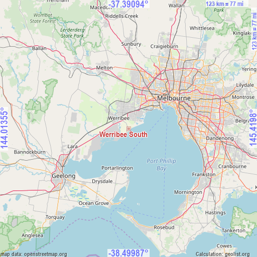
Werribee South GPS coordinates[2]
37° 56' 51" South, 144° 43' 0.012" East
| Map corner | latitude | longitude |
|---|---|---|
| Upper-left | -37.39094°, | 144.01355° |
| Center: | -37.9475°, | 144.71667° |
| Lower-right: | -38.49987°, | 145.4198° |
| Map W x H: | 123.3×123.3 km | = 76.6×76.6mi |
| max Lat: | -10.58257° ⇑91.2% North |
| Werribee South: | -37.9475° |
| min Lat: | ⇓8.8% South -43.31423° |
| min Long | Werribee South | max Long |
| 113.53327° | 144.71667° | 153.61246° |
| W 30.5%⇐ | ⇒69.5% E |
Elevation
Elevation of Werribee South is 8 m = 26 ft, and this is 114 m = 374 ft below average elevation for this country.
| Max E: |
1715 m = 5627 ft | 91.8% |
| Avg. | 122 m = 400 ft | |
| Werribee South | 8 m = 26 ft | |
Min E: |
-2 m = -7 ft | 8.2% |
See also: Australia elevation on elevation.city.
Geographical zone
Werribee South is located in South temperate zone (between Tropic of Capricorn and the Antarctic Circle). Distance of this Southern Tropic circle is 1613.4 km =1002.5 mi to North.| Distance of | km | miles | from Werribee South |
|---|---|---|---|
| Equator | 4219.4 | 2621.8 | to North |
| Tropic Capricorn | 1613.4 | 1002.5 | to North |
| Antarctic Circle | 3181.8 | 1977.1 | to South |
| South Pole | 5787.7 | 3596.3 | to South |


Nearby cities:
15 places around Werribee South: (largest is in red/bold)
• Altona
13.2 km =8.2 mi,  49°
49°
• Altona Meadows
9.2 km =5.7 mi,  39°
39°
• Altona North
17 km =10.6 mi, 42°
• Derrimut
17.9 km =11.1 mi,  15°
15°
• Hoppers Crossing
7.4 km =4.6 mi,  348°
348°
• Laverton
10.6 km =6.6 mi,  26°
26°
• Point Cook
4.7 km =2.9 mi, 39°
• Seabrook
8.3 km =5.2 mi, 26°
• Seaholme
14.6 km =9.1 mi, 50°
• Tarneit
13.3 km =8.3 mi,  337°
337°
• Truganina
14.8 km =9.2 mi,  11°
11°
• Werribee
6.9 km =4.3 mi,  320°
320°
• Williams Landing
9.8 km =6.1 mi, 13°
• Williamstown North
17.8 km =11.1 mi, 54°
• Wyndham Vale
10.3 km =6.4 mi,  307°
307°
Sources, notices
• [Note1] Compared only with cities in Australia existing in our database
• [Src1] Map data: © OpenStreetMap contributors (CC-BY-SA)
• [Src2] Other city data from geonames.org with taken over terms of usage.
• [Src3] Geographical zone / Annual Mean Temperature by Robert A. Rohde @ Wikipedia
