Napoleons geodata
Napoleons (Victoria) is a populated place; located in Australia in Australia/Melbourne (GMT+11) time zone. With population of 540 people, there are 4749 cities with bigger population in this country. Compared to other cities in Australia, 84.2% of cities are located further ↑North; 73% of cities are located further →East and 90.1% of cities have lower elevation than Napoleons. Note1


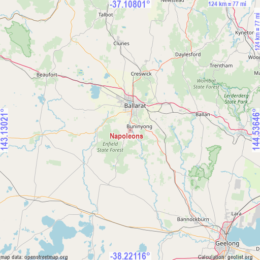
Napoleons GPS coordinates[2]
37° 40' 0.012" South, 143° 49' 59.988" East
| Map corner | latitude | longitude |
|---|---|---|
| Upper-left | -37.10801°, | 143.13021° |
| Center: | -37.66667°, | 143.83333° |
| Lower-right: | -38.22116°, | 144.53646° |
| Map W x H: | 123.8×123.8 km | = 76.9×76.9mi |
| max Lat: | -10.58257° ⇑84.2% North |
| Napoleons: | -37.66667° |
| min Lat: | ⇓15.8% South -43.31423° |
| min Long | Napoleons | max Long |
| 113.53327° | 143.83333° | 153.61246° |
| W 27%⇐ | ⇒73% E |
Elevation
Elevation of Napoleons is 381 m = 1250 ft, and this is 259 m = 850 ft above average elevation for this country.
| Max E: |
1715 m = 5627 ft | 9.9% |
| Napoleons | 381 m 1250 ft | |
| Avg. | 122 m = 400 ft | |
Min E: |
-2 m = -7 ft | 90.1% |
See also: Australia elevation on elevation.city.
Geographical zone
Napoleons is located in South temperate zone (between Tropic of Capricorn and the Antarctic Circle). Distance of this Southern Tropic circle is 1582.2 km =983.1 mi to North.| Distance of | km | miles | from Napoleons |
|---|---|---|---|
| Equator | 4188.1 | 2602.4 | to North |
| Tropic Capricorn | 1582.2 | 983.1 | to North |
| Antarctic Circle | 3213 | 1996.5 | to South |
| South Pole | 5818.9 | 3615.7 | to South |


Nearby cities:
15 places around Napoleons: (largest is in red/bold)
• Alfredton
11.2 km =7 mi,  352°
352°
• Ballarat
11.3 km =7 mi,  7°
7°
• Ballarat East
11.5 km =7.1 mi, 14°
• Buninyong
4.8 km =3 mi,  67°
67°
• Canadian
10.8 km =6.7 mi,  21°
21°
• Delacombe
8.8 km =5.5 mi, 349°
• Enfield
7.6 km =4.7 mi,  206°
206°
• Golden Point
10.7 km =6.6 mi, 16°
• Mount Clear
8.6 km =5.3 mi,  30°
30°
• Mount Helen
6.2 km =3.9 mi,  40°
40°
• Mount Pleasant
9.7 km =6 mi, 17°
• Redan
10 km =6.2 mi,  2°
2°
• Ross Creek
7.6 km =4.7 mi,  284°
284°
• Sebastopol
9.1 km =5.7 mi, 3°
• Smythes Creek
8.6 km =5.3 mi,  329°
329°
Sources, notices
• [Note1] Compared only with cities in Australia existing in our database
• [Src1] Map data: © OpenStreetMap contributors (CC-BY-SA)
• [Src2] Other city data from geonames.org with taken over terms of usage.
• [Src3] Geographical zone / Annual Mean Temperature by Robert A. Rohde @ Wikipedia
