Mulbring geodata
Mulbring (New South Wales) is a populated place; located in Australia in Australia/Sydney (GMT+11) time zone. With population of 586 people, there are 4609 cities with bigger population in this country. Compared to other cities in Australia, 59% of cities are located further ↓South; 77.6% of cities are located further ←West and 55% of cities have lower elevation than Mulbring. Note1


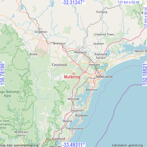
Mulbring GPS coordinates[2]
32° 54' 17.136" South, 151° 29' 6.288" East
| Map corner | latitude | longitude |
|---|---|---|
| Upper-left | -32.31247°, | 150.78196° |
| Center: | -32.90476°, | 151.48508° |
| Lower-right: | -33.49311°, | 152.18821° |
| Map W x H: | 131.3×131.3 km | = 81.6×81.6mi |
| max Lat: | -10.58257° ⇑41% North |
| Mulbring: | -32.90476° |
| min Lat: | ⇓59% South -43.31423° |
| min Long | Mulbring | max Long |
| 113.53327° | 151.48508° | 153.61246° |
| W 77.6%⇐ | ⇒22.4% E |
Elevation
Elevation of Mulbring is 53 m = 174 ft, and this is 69 m = 226 ft below average elevation for this country.
| Max E: |
1715 m = 5627 ft | 45% |
| Avg. | 122 m = 400 ft | |
| Mulbring | 53 m = 174 ft | |
Min E: |
-2 m = -7 ft | 55% |
See also: Australia elevation on elevation.city.
Geographical zone
Mulbring is located in South temperate zone (between Tropic of Capricorn and the Antarctic Circle). Distance of this Southern Tropic circle is 1052.7 km =654.1 mi to North.| Distance of | km | miles | from Mulbring |
|---|---|---|---|
| Equator | 3658.7 | 2273.4 | to North |
| Tropic Capricorn | 1052.7 | 654.1 | to North |
| Antarctic Circle | 3742.5 | 2325.5 | to South |
| South Pole | 6348.4 | 3944.7 | to South |


Nearby cities:
15 places around Mulbring: (largest is in red/bold)
• Aberdare
12 km =7.5 mi,  306°
306°
• Abermain
12.1 km =7.5 mi,  333°
333°
• Barnsley
9.7 km =6 mi,  109°
109°
• Cameron Park
11.2 km =7 mi,  91°
91°
• Edgeworth
12.4 km =7.7 mi,  100°
100°
• Heddon Greta
11.7 km =7.3 mi,  12°
12°
• Holmesville
9.3 km =5.8 mi, 98°
• Kearsley
9.8 km =6.1 mi,  304°
304°
• Killingworth
7.4 km =4.6 mi,  116°
116°
• Kurri Kurri
9.5 km =5.9 mi,  356°
356°
• Minmi
12.7 km =7.9 mi,  76°
76°
• Pelaw Main
7.5 km =4.7 mi, 357°
• Stanford Merthyr
8.9 km =5.5 mi, 5°
• Teralba
12.7 km =7.9 mi, 122°
• West Wallsend
9.2 km =5.7 mi, 86°
Sources, notices
• [Note1] Compared only with cities in Australia existing in our database
• [Src1] Map data: © OpenStreetMap contributors (CC-BY-SA)
• [Src2] Other city data from geonames.org with taken over terms of usage.
• [Src3] Geographical zone / Annual Mean Temperature by Robert A. Rohde @ Wikipedia
