Mount Morgan geodata
Mount Morgan (Queensland) is a populated place; located in Australia in Australia/Brisbane (GMT+10) time zone. With population of 1,926 people, there are 2954 cities with bigger population in this country. Compared to other cities in Australia, 91.4% of cities are located further ↓South; 58.1% of cities are located further ←West and 84.8% of cities have lower elevation than Mount Morgan. Note1


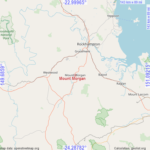
Mount Morgan GPS coordinates[2]
23° 38' 43.152" South, 150° 23' 20.472" East
| Map corner | latitude | longitude |
|---|---|---|
| Upper-left | -22.99965°, | 149.6859° |
| Center: | -23.64532°, | 150.38902° |
| Lower-right: | -24.28782°, | 151.09215° |
| Map W x H: | 143.2×143.2 km | = 89×89mi |
| max Lat: | -10.58257° ⇑8.6% North |
| Mount Morgan: | -23.64532° |
| min Lat: | ⇓91.4% South -43.31423° |
| min Long | Mount Morgan | max Long |
| 113.53327° | 150.38902° | 153.61246° |
| W 58.1%⇐ | ⇒41.9% E |
Elevation
Elevation of Mount Morgan is 243 m = 797 ft, and this is 121 m = 397 ft above average elevation for this country.
| Max E: |
1715 m = 5627 ft | 15.2% |
| Mount Morgan | 243 m 797 ft | |
| Avg. | 122 m = 400 ft | |
Min E: |
-2 m = -7 ft | 84.8% |
See also: Australia elevation on elevation.city.
Geographical zone
Mount Morgan is located in South temperate zone (between Tropic of Capricorn and the Antarctic Circle). Distance of this Southern Tropic circle is 23.2 km =14.4 mi to North.| Distance of | km | miles | from Mount Morgan |
|---|---|---|---|
| Equator | 2629.1 | 1633.6 | to North |
| Tropic Capricorn | 23.2 | 14.4 | to North |
| Antarctic Circle | 4772.1 | 2965.2 | to South |
| South Pole | 7377.9 | 4584.4 | to South |


Nearby cities:
15 places around Mount Morgan: (largest is in red/bold)
• Allenstown
30.3 km =18.8 mi,  22°
22°
• Berserker
34.6 km =21.5 mi, 22°
• Bouldercombe
11.7 km =7.3 mi,  44°
44°
• Depot Hill
31.4 km =19.5 mi,  25°
25°
• Frenchville
36.7 km =22.8 mi, 25°
• Gracemere
24.1 km =15 mi, 16°
• Kawana
36 km =22.4 mi, 19°
• Koongal
34.8 km =21.6 mi, 27°
• Lakes Creek
36.8 km =22.9 mi, 31°
• Norman Gardens
37.8 km =23.5 mi, 21°
• Park Avenue
35.1 km =21.8 mi, 22°
• Rockhampton
31.8 km =19.8 mi, 22°
• The Range
30.2 km =18.8 mi, 21°
• Wandal
32.6 km =20.3 mi, 19°
• West Rockhampton
31 km =19.3 mi, 17°
Sources, notices
• [Note1] Compared only with cities in Australia existing in our database
• [Src1] Map data: © OpenStreetMap contributors (CC-BY-SA)
• [Src2] Other city data from geonames.org with taken over terms of usage.
• [Src3] Geographical zone / Annual Mean Temperature by Robert A. Rohde @ Wikipedia
