Coolamon geodata
Coolamon (New South Wales) is a populated place; located in Australia in Australia/Sydney (GMT+11) time zone. With population of 2,131 people, there are 2803 cities with bigger population in this country. Compared to other cities in Australia, 66% of cities are located further ↑North; 51.9% of cities are located further →East and 85% of cities have lower elevation than Coolamon. Note1


Coolamon GPS coordinates[2]
34° 48' 59.076" South, 147° 11' 44.772" East
| Map corner | latitude | longitude |
|---|---|---|
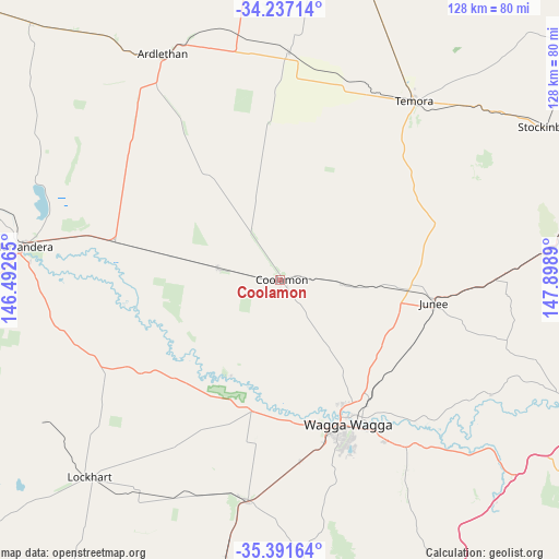
| Upper-left | -34.23714°, | 146.49265° |
| Center: | -34.81641°, | 147.19577° |
| Lower-right: | -35.39164°, | 147.8989° |
| Map W x H: | 128.4×128.4 km | = 79.8×79.8mi |
| max Lat: | -10.58257° ⇑66% North |
| Coolamon: | -34.81641° |
| min Lat: | ⇓34% South -43.31423° |
| min Long | Coolamon | max Long |
| 113.53327° | 147.19577° | 153.61246° |
| W 48.1%⇐ | ⇒51.9% E |
Elevation
Elevation of Coolamon is 247 m = 810 ft, and this is 125 m = 410 ft above average elevation for this country.
| Max E: |
1715 m = 5627 ft | 15% |
| Coolamon | 247 m 810 ft | |
| Avg. | 122 m = 400 ft | |
Min E: |
-2 m = -7 ft | 85% |
See also: Australia elevation on elevation.city.
Geographical zone
Coolamon is located in South temperate zone (between Tropic of Capricorn and the Antarctic Circle). Distance of this Southern Tropic circle is 1265.3 km =786.2 mi to North.| Distance of | km | miles | from Coolamon |
|---|---|---|---|
| Equator | 3871.2 | 2405.5 | to North |
| Tropic Capricorn | 1265.3 | 786.2 | to North |
| Antarctic Circle | 3530 | 2193.4 | to South |
| South Pole | 6135.8 | 3812.6 | to South |


Nearby cities:
15 places around Coolamon: (largest is in red/bold)
• Ashmont
36.5 km =22.7 mi,  160°
160°
• Boorooma
32.5 km =20.2 mi,  151°
151°
• Bourkelands
40.2 km =25 mi, 159°
• Charles Sturt University
30.8 km =19.1 mi, 152°
• Estella
32.1 km =19.9 mi, 152°
• Ganmain
14.5 km =9 mi,  280°
280°
• Glenfield Park
37.8 km =23.5 mi, 160°
• Junee
35.8 km =22.2 mi,  99°
99°
• Kapooka
38.7 km =24 mi,  167°
167°
• Kooringal
39.6 km =24.6 mi, 155°
• Lloyd
39.3 km =24.4 mi, 160°
• Mount Austin
38.4 km =23.9 mi, 158°
• Tolland
39.2 km =24.4 mi, 158°
• Turvey Park
37.9 km =23.5 mi, 156°
• Wagga Wagga
37.3 km =23.2 mi, 157°
Sources, notices
• [Note1] Compared only with cities in Australia existing in our database
• [Src1] Map data: © OpenStreetMap contributors (CC-BY-SA)
• [Src2] Other city data from geonames.org with taken over terms of usage.
• [Src3] Geographical zone / Annual Mean Temperature by Robert A. Rohde @ Wikipedia
