Bannockburn geodata
Bannockburn (Victoria) is a populated place; located in Australia in Australia/Melbourne (GMT+11) time zone. With population of 5,203 people, there are 1425 cities with bigger population in this country. Compared to other cities in Australia, 92.2% of cities are located further ↑North; 72.1% of cities are located further →East and 72.8% of cities have lower elevation than Bannockburn. Note1


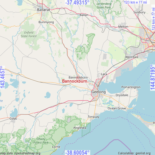
Bannockburn GPS coordinates[2]
38° 2' 56.184" South, 144° 10' 7.752" East
| Map corner | latitude | longitude |
|---|---|---|
| Upper-left | -37.49315°, | 143.4657° |
| Center: | -38.04894°, | 144.16882° |
| Lower-right: | -38.60054°, | 144.87195° |
| Map W x H: | 123.1×123.1 km | = 76.5×76.5mi |
| max Lat: | -10.58257° ⇑92.2% North |
| Bannockburn: | -38.04894° |
| min Lat: | ⇓7.8% South -43.31423° |
| min Long | Bannockburn | max Long |
| 113.53327° | 144.16882° | 153.61246° |
| W 27.9%⇐ | ⇒72.1% E |
Elevation
Elevation of Bannockburn is 116 m = 381 ft, and this is 6 m = 20 ft below average elevation for this country.
| Max E: |
1715 m = 5627 ft | 27.2% |
| Avg. | 122 m = 400 ft | |
| Bannockburn | 116 m = 381 ft | |
Min E: |
-2 m = -7 ft | 72.8% |
See also: Australia elevation on elevation.city.
Geographical zone
Bannockburn is located in South temperate zone (between Tropic of Capricorn and the Antarctic Circle). Distance of this Southern Tropic circle is 1624.7 km =1009.5 mi to North.| Distance of | km | miles | from Bannockburn |
|---|---|---|---|
| Equator | 4230.6 | 2628.8 | to North |
| Tropic Capricorn | 1624.7 | 1009.5 | to North |
| Antarctic Circle | 3170.5 | 1970.1 | to South |
| South Pole | 5776.4 | 3589.3 | to South |


Nearby cities:
15 places around Bannockburn: (largest is in red/bold)
• Anakie
16.3 km =10.1 mi,  25°
25°
• Batesford
10.5 km =6.5 mi,  114°
114°
• Bell Park
16.2 km =10.1 mi, 113°
• Bell Post Hill
14.2 km =8.8 mi, 111°
• Hamlyn Heights
16.1 km =10 mi,  119°
119°
• Herne Hill
16.6 km =10.3 mi, 124°
• Highton
18.4 km =11.4 mi,  137°
137°
• Inverleigh
11.8 km =7.3 mi,  240°
240°
• Lethbridge
9.7 km =6 mi,  342°
342°
• Lovely Banks
14.5 km =9 mi,  97°
97°
• Manifold Heights
17.5 km =10.9 mi, 124°
• Norlane
17.2 km =10.7 mi, 109°
• North Geelong
17.3 km =10.7 mi, 112°
• Rippleside
18.4 km =11.4 mi, 117°
• Teesdale
10.5 km =6.5 mi,  279°
279°
Sources, notices
• [Note1] Compared only with cities in Australia existing in our database
• [Src1] Map data: © OpenStreetMap contributors (CC-BY-SA)
• [Src2] Other city data from geonames.org with taken over terms of usage.
• [Src3] Geographical zone / Annual Mean Temperature by Robert A. Rohde @ Wikipedia
