Lilyfield geodata
Lilyfield (New South Wales) is a section of populated place; located in Australia in Australia/Sydney (GMT+11) time zone. With population of 7,594 people, there are 890 cities with bigger population in this country. Compared to other cities in Australia, 54.8% of cities are located further ↑North; 72.2% of cities are located further ←West and 73.6% of cities have higher elevation than Lilyfield. Note1


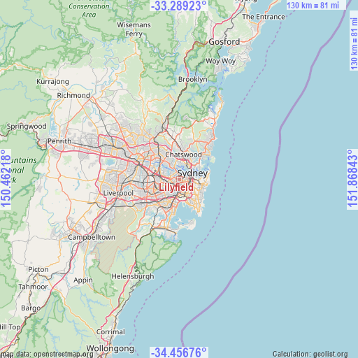
Lilyfield GPS coordinates[2]
33° 52' 29.964" South, 151° 9' 55.08" East
| Map corner | latitude | longitude |
|---|---|---|
| Upper-left | -33.28923°, | 150.46218° |
| Center: | -33.87499°, | 151.1653° |
| Lower-right: | -34.45676°, | 151.86843° |
| Map W x H: | 129.8×129.8 km | = 80.7×80.7mi |
| max Lat: | -10.58257° ⇑54.8% North |
| Lilyfield: | -33.87499° |
| min Lat: | ⇓45.2% South -43.31423° |
| min Long | Lilyfield | max Long |
| 113.53327° | 151.1653° | 153.61246° |
| W 72.2%⇐ | ⇒27.8% E |
Elevation
Elevation of Lilyfield is 20 m = 66 ft, and this is 102 m = 335 ft below average elevation for this country.
| Max E: |
1715 m = 5627 ft | 73.6% |
| Avg. | 122 m = 400 ft | |
| Lilyfield | 20 m = 66 ft | |
Min E: |
-2 m = -7 ft | 26.4% |
See also: Australia elevation on elevation.city.
Geographical zone
Lilyfield is located in South temperate zone (between Tropic of Capricorn and the Antarctic Circle). Distance of this Southern Tropic circle is 1160.6 km =721.2 mi to North.| Distance of | km | miles | from Lilyfield |
|---|---|---|---|
| Equator | 3766.5 | 2340.4 | to North |
| Tropic Capricorn | 1160.6 | 721.2 | to North |
| Antarctic Circle | 3634.6 | 2258.4 | to South |
| South Pole | 6240.5 | 3877.7 | to South |


Nearby cities:
15 places around Lilyfield: (largest is in red/bold)
• Annandale
0.9 km =0.6 mi,  172°
172°
• Balmain
2.8 km =1.7 mi,  36°
36°
• Camperdown
1.9 km =1.2 mi,  147°
147°
• Drummoyne
2.7 km =1.7 mi,  339°
339°
• Enmore
2.9 km =1.8 mi, 165°
• Forest Lodge
1.5 km =0.9 mi,  117°
117°
• Glebe
1.8 km =1.1 mi,  103°
103°
• Haberfield
2.2 km =1.4 mi,  245°
245°
• Leichhardt
1.3 km =0.8 mi,  221°
221°
• Newtown
2.8 km =1.7 mi,  156°
156°
• Petersham
2.4 km =1.5 mi,  203°
203°
• Pyrmont
2.7 km =1.7 mi,  77°
77°
• Rodd Point
2.5 km =1.6 mi,  291°
291°
• Rozelle
1.6 km =1 mi,  17°
17°
• Stanmore
2.1 km =1.3 mi,  182°
182°
Sources, notices
• [Note1] Compared only with cities in Australia existing in our database
• [Src1] Map data: © OpenStreetMap contributors (CC-BY-SA)
• [Src2] Other city data from geonames.org with taken over terms of usage.
• [Src3] Geographical zone / Annual Mean Temperature by Robert A. Rohde @ Wikipedia
