Kurmond geodata
Kurmond (New South Wales) is a populated place; located in Australia in Australia/Sydney (GMT+11) time zone. With population of 817 people, there are 4112 cities with bigger population in this country. Compared to other cities in Australia, 53% of cities are located further ↓South; 60.7% of cities are located further ←West and 70.4% of cities have lower elevation than Kurmond. Note1


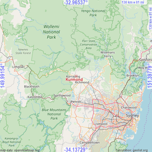
Kurmond GPS coordinates[2]
33° 33' 11.952" South, 150° 41' 40.776" East
| Map corner | latitude | longitude |
|---|---|---|
| Upper-left | -32.96537°, | 149.99154° |
| Center: | -33.55332°, | 150.69466° |
| Lower-right: | -34.13729°, | 151.39779° |
| Map W x H: | 130.3×130.3 km | = 81×81mi |
| max Lat: | -10.58257° ⇑47% North |
| Kurmond: | -33.55332° |
| min Lat: | ⇓53% South -43.31423° |
| min Long | Kurmond | max Long |
| 113.53327° | 150.69466° | 153.61246° |
| W 60.7%⇐ | ⇒39.3% E |
Elevation
Elevation of Kurmond is 105 m = 344 ft, and this is 17 m = 56 ft below average elevation for this country.
| Max E: |
1715 m = 5627 ft | 29.6% |
| Avg. | 122 m = 400 ft | |
| Kurmond | 105 m = 344 ft | |
Min E: |
-2 m = -7 ft | 70.4% |
See also: Australia elevation on elevation.city.
Geographical zone
Kurmond is located in South temperate zone (between Tropic of Capricorn and the Antarctic Circle). Distance of this Southern Tropic circle is 1124.9 km =699 mi to North.| Distance of | km | miles | from Kurmond |
|---|---|---|---|
| Equator | 3730.8 | 2318.2 | to North |
| Tropic Capricorn | 1124.9 | 699 | to North |
| Antarctic Circle | 3670.4 | 2280.7 | to South |
| South Pole | 6276.3 | 3899.9 | to South |


Nearby cities:
15 places around Kurmond: (largest is in red/bold)
• Agnes Banks
6.6 km =4.1 mi,  161°
161°
• Bowen Mountain
6.7 km =4.2 mi,  252°
252°
• East Kurrajong
10.7 km =6.6 mi,  60°
60°
• Freemans Reach
9.4 km =5.8 mi,  93°
93°
• Glossodia
7.6 km =4.7 mi,  75°
75°
• Grose Vale
3.8 km =2.4 mi,  209°
209°
• Grose Wold
5.1 km =3.2 mi,  190°
190°
• Hobartville
7.2 km =4.5 mi,  141°
141°
• Kurrajong Heights
6.7 km =4.2 mi,  295°
295°
• Kurrajong Hills
4.6 km =2.9 mi, 299°
• Londonderry
11 km =6.8 mi, 160°
• North Richmond
3.9 km =2.4 mi, 143°
• Richmond
7.4 km =4.6 mi,  134°
134°
• South Windsor
12.5 km =7.8 mi, 125°
• Yarramundi
7.6 km =4.7 mi, 194°
Sources, notices
• [Note1] Compared only with cities in Australia existing in our database
• [Src1] Map data: © OpenStreetMap contributors (CC-BY-SA)
• [Src2] Other city data from geonames.org with taken over terms of usage.
• [Src3] Geographical zone / Annual Mean Temperature by Robert A. Rohde @ Wikipedia
