Cook geodata
Cook (ACT) is a section of populated place; located in Australia in Australia/Sydney (GMT+11) time zone. With population of 2,748 people, there are 2412 cities with bigger population in this country. Compared to other cities in Australia, 75.1% of cities are located further ↑North; 53.3% of cities are located further ←West and 96.8% of cities have lower elevation than Cook. Note1


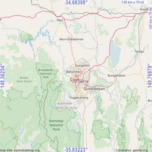
Cook GPS coordinates[2]
35° 15' 36.504" South, 149° 3' 56.376" East
| Map corner | latitude | longitude |
|---|---|---|
| Upper-left | -34.68398°, | 148.36254° |
| Center: | -35.26014°, | 149.06566° |
| Lower-right: | -35.83223°, | 149.76879° |
| Map W x H: | 127.7×127.7 km | = 79.3×79.3mi |
| max Lat: | -10.58257° ⇑75.1% North |
| Cook: | -35.26014° |
| min Lat: | ⇓24.9% South -43.31423° |
| min Long | Cook | max Long |
| 113.53327° | 149.06566° | 153.61246° |
| W 53.3%⇐ | ⇒46.7% E |
Elevation
Elevation of Cook is 627 m = 2057 ft, and this is 505 m = 1657 ft above average elevation for this country.
| Max E: |
1715 m = 5627 ft | 3.2% |
| Cook | 627 m 2057 ft | |
| Avg. | 122 m = 400 ft | |
Min E: |
-2 m = -7 ft | 96.8% |
See also: Australia elevation on elevation.city.
Geographical zone
Cook is located in South temperate zone (between Tropic of Capricorn and the Antarctic Circle). Distance of this Southern Tropic circle is 1314.6 km =816.9 mi to North.| Distance of | km | miles | from Cook |
|---|---|---|---|
| Equator | 3920.6 | 2436.1 | to North |
| Tropic Capricorn | 1314.6 | 816.9 | to North |
| Antarctic Circle | 3480.6 | 2162.7 | to South |
| South Pole | 6086.5 | 3782 | to South |


Nearby cities:
15 places around Cook: (largest is in red/bold)
• Acton
5.2 km =3.2 mi,  112°
112°
• Aranda
1.4 km =0.9 mi,  80°
80°
• Belconnen
2.5 km =1.6 mi,  1°
1°
• Bruce
2.9 km =1.8 mi,  51°
51°
• Evatt
5.4 km =3.4 mi, 3°
• Florey
4.1 km =2.5 mi,  339°
339°
• Hawker
3 km =1.9 mi,  298°
298°
• Higgins
4.7 km =2.9 mi,  311°
311°
• Macquarie
1 km =0.6 mi,  349°
349°
• McKellar
4.9 km =3 mi,  12°
12°
• O'Connor
4.3 km =2.7 mi, 84°
• Page
2.8 km =1.7 mi,  329°
329°
• Scullin
3.7 km =2.3 mi,  319°
319°
• Turner
5.4 km =3.4 mi,  100°
100°
• Weetangera
1.8 km =1.1 mi, 308°
Sources, notices
• [Note1] Compared only with cities in Australia existing in our database
• [Src1] Map data: © OpenStreetMap contributors (CC-BY-SA)
• [Src2] Other city data from geonames.org with taken over terms of usage.
• [Src3] Geographical zone / Annual Mean Temperature by Robert A. Rohde @ Wikipedia
