Hawker geodata
Hawker (ACT) is a section of populated place; located in Australia in Australia/Sydney (GMT+11) time zone. With population of 2,962 people, there are 2275 cities with bigger population in this country. Compared to other cities in Australia, 74.9% of cities are located further ↑North; 52.9% of cities are located further ←West and 97% of cities have lower elevation than Hawker. Note1


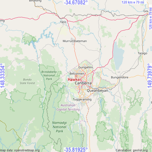
Hawker GPS coordinates[2]
35° 14' 49.452" South, 149° 2' 11.976" East
| Map corner | latitude | longitude |
|---|---|---|
| Upper-left | -34.67082°, | 148.33354° |
| Center: | -35.24707°, | 149.03666° |
| Lower-right: | -35.81925°, | 149.73979° |
| Map W x H: | 127.7×127.7 km | = 79.3×79.3mi |
| max Lat: | -10.58257° ⇑74.9% North |
| Hawker: | -35.24707° |
| min Lat: | ⇓25.1% South -43.31423° |
| min Long | Hawker | max Long |
| 113.53327° | 149.03666° | 153.61246° |
| W 52.9%⇐ | ⇒47.1% E |
Elevation
Elevation of Hawker is 632 m = 2073 ft, and this is 510 m = 1673 ft above average elevation for this country.
| Max E: |
1715 m = 5627 ft | 3% |
| Hawker | 632 m 2073 ft | |
| Avg. | 122 m = 400 ft | |
Min E: |
-2 m = -7 ft | 97% |
See also: Australia elevation on elevation.city.
Geographical zone
Hawker is located in South temperate zone (between Tropic of Capricorn and the Antarctic Circle). Distance of this Southern Tropic circle is 1313.2 km =816 mi to North.| Distance of | km | miles | from Hawker |
|---|---|---|---|
| Equator | 3919.1 | 2435.2 | to North |
| Tropic Capricorn | 1313.2 | 816 | to North |
| Antarctic Circle | 3482.1 | 2163.7 | to South |
| South Pole | 6088 | 3782.9 | to South |


Nearby cities:
15 places around Hawker: (largest is in red/bold)
• Aranda
4.2 km =2.6 mi,  107°
107°
• Belconnen
2.9 km =1.8 mi,  69°
69°
• Cook
3 km =1.9 mi,  118°
118°
• Evatt
4.9 km =3 mi,  36°
36°
• Florey
2.6 km =1.6 mi,  27°
27°
• Flynn
4.6 km =2.9 mi,  8°
8°
• Higgins
1.8 km =1.1 mi,  332°
332°
• Holt
3.4 km =2.1 mi,  318°
318°
• Latham
3.4 km =2.1 mi,  352°
352°
• Macgregor
4.8 km =3 mi, 330°
• Macquarie
2.5 km =1.6 mi,  100°
100°
• Melba
4.4 km =2.7 mi,  21°
21°
• Page
1.5 km =0.9 mi,  52°
52°
• Scullin
1.4 km =0.9 mi, 8°
• Weetangera
1.3 km =0.8 mi, 105°
Sources, notices
• [Note1] Compared only with cities in Australia existing in our database
• [Src1] Map data: © OpenStreetMap contributors (CC-BY-SA)
• [Src2] Other city data from geonames.org with taken over terms of usage.
• [Src3] Geographical zone / Annual Mean Temperature by Robert A. Rohde @ Wikipedia
