Lyneham geodata
Lyneham (ACT) is a section of populated place; located in Australia in Australia/Sydney (GMT+11) time zone. With population of 5,085 people, there are 1452 cities with bigger population in this country. Compared to other cities in Australia, 74.8% of cities are located further ↑North; 54.6% of cities are located further ←West and 94.9% of cities have lower elevation than Lyneham. Note1


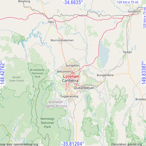
Lyneham GPS coordinates[2]
35° 14' 23.28" South, 149° 7' 50.664" East
| Map corner | latitude | longitude |
|---|---|---|
| Upper-left | -34.6635°, | 148.42762° |
| Center: | -35.2398°, | 149.13074° |
| Lower-right: | -35.81204°, | 149.83387° |
| Map W x H: | 127.7×127.7 km | = 79.3×79.3mi |
| max Lat: | -10.58257° ⇑74.8% North |
| Lyneham: | -35.2398° |
| min Lat: | ⇓25.2% South -43.31423° |
| min Long | Lyneham | max Long |
| 113.53327° | 149.13074° | 153.61246° |
| W 54.6%⇐ | ⇒45.4% E |
Elevation
Elevation of Lyneham is 580 m = 1903 ft, and this is 458 m = 1503 ft above average elevation for this country.
| Max E: |
1715 m = 5627 ft | 5.1% |
| Lyneham | 580 m 1903 ft | |
| Avg. | 122 m = 400 ft | |
Min E: |
-2 m = -7 ft | 94.9% |
See also: Australia elevation on elevation.city.
Geographical zone
Lyneham is located in South temperate zone (between Tropic of Capricorn and the Antarctic Circle). Distance of this Southern Tropic circle is 1312.4 km =815.5 mi to North.| Distance of | km | miles | from Lyneham |
|---|---|---|---|
| Equator | 3918.3 | 2434.7 | to North |
| Tropic Capricorn | 1312.4 | 815.5 | to North |
| Antarctic Circle | 3482.9 | 2164.2 | to South |
| South Pole | 6088.8 | 3783.4 | to South |


Nearby cities:
15 places around Lyneham: (largest is in red/bold)
• Acton
4.4 km =2.7 mi,  195°
195°
• Ainslie
2.8 km =1.7 mi,  155°
155°
• Braddon
3.5 km =2.2 mi,  172°
172°
• Bruce
3.7 km =2.3 mi,  262°
262°
• City
4.6 km =2.9 mi,  181°
181°
• Crace
4.6 km =2.9 mi,  332°
332°
• Dickson
1.5 km =0.9 mi,  147°
147°
• Downer
1.4 km =0.9 mi,  112°
112°
• Franklin
4.6 km =2.9 mi,  14°
14°
• Giralang
4.5 km =2.8 mi,  315°
315°
• Hackett
3.2 km =2 mi, 109°
• Kaleen
3.3 km =2.1 mi, 316°
• O'Connor
2.5 km =1.6 mi,  221°
221°
• Turner
3.3 km =2.1 mi,  189°
189°
• Watson
2 km =1.2 mi,  84°
84°
Sources, notices
• [Note1] Compared only with cities in Australia existing in our database
• [Src1] Map data: © OpenStreetMap contributors (CC-BY-SA)
• [Src2] Other city data from geonames.org with taken over terms of usage.
• [Src3] Geographical zone / Annual Mean Temperature by Robert A. Rohde @ Wikipedia
