Parkside geodata
Parkside (Queensland) is a section of populated place; located in Australia in Australia/Brisbane (GMT+10) time zone. With population of 1,503 people, there are 3275 cities with bigger population in this country. Compared to other cities in Australia, 93.9% of cities are located further ↓South; 76.4% of cities are located further →East and 89.4% of cities have lower elevation than Parkside. Note1


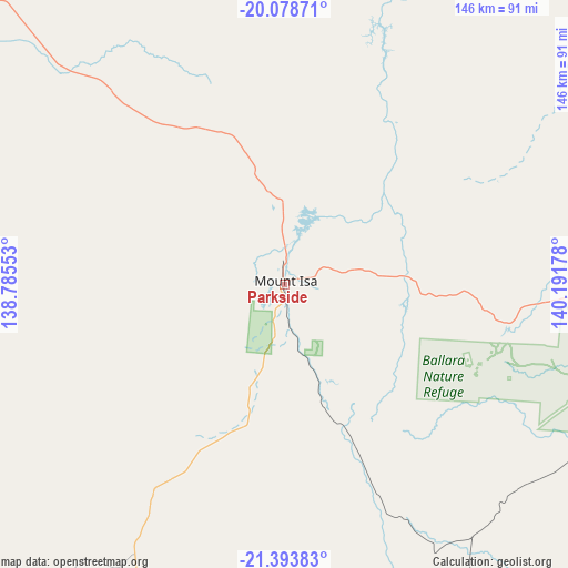
Parkside GPS coordinates[2]
20° 44' 15.72" South, 139° 29' 19.14" East
| Map corner | latitude | longitude |
|---|---|---|
| Upper-left | -20.07871°, | 138.78553° |
| Center: | -20.7377°, | 139.48865° |
| Lower-right: | -21.39383°, | 140.19178° |
| Map W x H: | 146.2×146.2 km | = 90.8×90.8mi |
| max Lat: | -10.58257° ⇑6.1% North |
| Parkside: | -20.7377° |
| min Lat: | ⇓93.9% South -43.31423° |
| min Long | Parkside | max Long |
| 113.53327° | 139.48865° | 153.61246° |
| W 23.6%⇐ | ⇒76.4% E |
Elevation
Elevation of Parkside is 357 m = 1171 ft, and this is 235 m = 771 ft above average elevation for this country.
| Max E: |
1715 m = 5627 ft | 10.6% |
| Parkside | 357 m 1171 ft | |
| Avg. | 122 m = 400 ft | |
Min E: |
-2 m = -7 ft | 89.4% |
See also: Australia elevation on elevation.city.
Geographical zone
Parkside is located in South Torrid zone (between Equator and Tropic of Capricorn). Distance of this Southern Tropic circle is 300.1 km =186.5 mi to South.| Distance of | km | miles | from Parkside |
|---|---|---|---|
| Equator | 2305.8 | 1432.8 | to North |
| Tropic Capricorn | 300.1 | 186.5 | to South |
| Antarctic Circle | 5095.4 | 3166.1 | to South |
| South Pole | 7701.2 | 4785.3 | to South |


Nearby cities:
15 places around Parkside: (largest is in red/bold)
• Camooweal
169.1 km =105.1 mi,  302°
302°
• Cloncurry
106.6 km =66.2 mi,  88°
88°
• Doomadgee
318.3 km =197.8 mi,  347°
347°
• Happy Valley
1.1 km =0.7 mi,  169°
169°
• Healy
1.5 km =0.9 mi,  127°
127°
• Julia Creek
234.5 km =145.7 mi, 87°
• McKinlay
197 km =122.4 mi,  107°
107°
• Menzies
2.4 km =1.5 mi,  22°
22°
• Mornington
0.8 km =0.5 mi,  62°
62°
• Mount Isa
1.7 km =1.1 mi,  32°
32°
• Pioneer
2.8 km =1.7 mi,  46°
46°
• Soldiers Hill
3.6 km =2.2 mi,  2°
2°
• Sunset
3.7 km =2.3 mi, 33°
• Townview
1.8 km =1.1 mi,  71°
71°
• Winston
3.9 km =2.4 mi, 16°
Sources, notices
• [Note1] Compared only with cities in Australia existing in our database
• [Src1] Map data: © OpenStreetMap contributors (CC-BY-SA)
• [Src2] Other city data from geonames.org with taken over terms of usage.
• [Src3] Geographical zone / Annual Mean Temperature by Robert A. Rohde @ Wikipedia
