Doomadgee geodata
Doomadgee (Queensland) is a populated place; located in Australia in Australia/Brisbane (GMT+10) time zone. With population of 1,468 people, there are 3309 cities with bigger population in this country. Compared to other cities in Australia, 96.2% of cities are located further ↓South; 77.2% of cities are located further →East and 52% of cities have lower elevation than Doomadgee. Note1


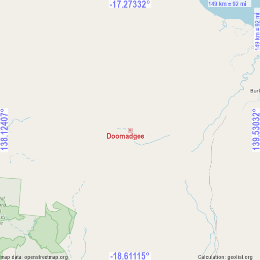
Doomadgee GPS coordinates[2]
17° 56' 36.6" South, 138° 49' 37.884" East
| Map corner | latitude | longitude |
|---|---|---|
| Upper-left | -17.27332°, | 138.12407° |
| Center: | -17.9435°, | 138.82719° |
| Lower-right: | -18.61115°, | 139.53032° |
| Map W x H: | 148.8×148.8 km | = 92.5×92.5mi |
| max Lat: | -10.58257° ⇑3.8% North |
| Doomadgee: | -17.9435° |
| min Lat: | ⇓96.2% South -43.31423° |
| min Long | Doomadgee | max Long |
| 113.53327° | 138.82719° | 153.61246° |
| W 22.8%⇐ | ⇒77.2% E |
Elevation
Elevation of Doomadgee is 48 m = 157 ft, and this is 74 m = 243 ft below average elevation for this country.
| Max E: |
1715 m = 5627 ft | 48% |
| Avg. | 122 m = 400 ft | |
| Doomadgee | 48 m = 157 ft | |
Min E: |
-2 m = -7 ft | 52% |
See also: Australia elevation on elevation.city.
Geographical zone
Doomadgee is located in South Torrid zone (between Equator and Tropic of Capricorn). Distance of this Southern Tropic circle is 610.8 km =379.5 mi to South.| Distance of | km | miles | from Doomadgee |
|---|---|---|---|
| Equator | 1995.1 | 1239.7 | to North |
| Tropic Capricorn | 610.8 | 379.5 | to South |
| Antarctic Circle | 5406 | 3359.1 | to South |
| South Pole | 8011.9 | 4978.4 | to South |


Nearby cities:
15 places around Doomadgee: (largest is in red/bold)
• Camooweal
232.2 km =144.3 mi,  198°
198°
• Happy Valley
319.5 km =198.5 mi,  167°
167°
• Healy
319.5 km =198.5 mi, 167°
• Karumba
219.4 km =136.3 mi,  76°
76°
• Menzies
316.4 km =196.6 mi, 167°
• Mornington
318.1 km =197.7 mi, 167°
• Mount Isa
317.2 km =197.1 mi, 167°
• Normanton
240.1 km =149.2 mi, 82°
• Parkside
318.3 km =197.8 mi, 167°
• Pioneer
316.9 km =196.9 mi, 166°
• Soldiers Hill
314.9 km =195.7 mi, 167°
• Sunset
315.8 km =196.2 mi, 166°
• Townview
318.2 km =197.7 mi, 167°
• Wellesley Islands
158.1 km =98.2 mi,  22°
22°
• Winston
314.9 km =195.7 mi, 167°
Sources, notices
• [Note1] Compared only with cities in Australia existing in our database
• [Src1] Map data: © OpenStreetMap contributors (CC-BY-SA)
• [Src2] Other city data from geonames.org with taken over terms of usage.
• [Src3] Geographical zone / Annual Mean Temperature by Robert A. Rohde @ Wikipedia
