Kalkie geodata
Kalkie (Queensland) is a section of populated place; located in Australia in Australia/Brisbane (GMT+10) time zone. With population of 2,650 people, there are 2467 cities with bigger population in this country. Compared to other cities in Australia, 90.3% of cities are located further ↓South; 84% of cities are located further ←West and 81.9% of cities have higher elevation than Kalkie. Note1


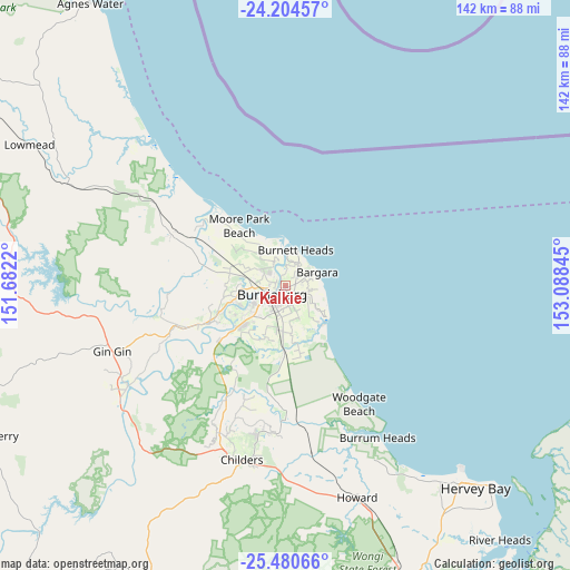
Kalkie GPS coordinates[2]
24° 50' 39.336" South, 152° 23' 7.152" East
| Map corner | latitude | longitude |
|---|---|---|
| Upper-left | -24.20457°, | 151.6822° |
| Center: | -24.84426°, | 152.38532° |
| Lower-right: | -25.48066°, | 153.08845° |
| Map W x H: | 141.9×141.9 km | = 88.2×88.2mi |
| max Lat: | -10.58257° ⇑9.7% North |
| Kalkie: | -24.84426° |
| min Lat: | ⇓90.3% South -43.31423° |
| min Long | Kalkie | max Long |
| 113.53327° | 152.38532° | 153.61246° |
| W 84%⇐ | ⇒16% E |
Elevation
Elevation of Kalkie is 14 m = 46 ft, and this is 108 m = 354 ft below average elevation for this country.
| Max E: |
1715 m = 5627 ft | 81.9% |
| Avg. | 122 m = 400 ft | |
| Kalkie | 14 m = 46 ft | |
Min E: |
-2 m = -7 ft | 18.1% |
See also: Australia elevation on elevation.city.
Geographical zone
Kalkie is located in South temperate zone (between Tropic of Capricorn and the Antarctic Circle). Distance of this Southern Tropic circle is 156.5 km =97.2 mi to North.| Distance of | km | miles | from Kalkie |
|---|---|---|---|
| Equator | 2762.4 | 1716.5 | to North |
| Tropic Capricorn | 156.5 | 97.2 | to North |
| Antarctic Circle | 4638.8 | 2882.4 | to South |
| South Pole | 7244.6 | 4501.6 | to South |


Nearby cities:
15 places around Kalkie: (largest is in red/bold)
• Ashfield
3.3 km =2.1 mi,  162°
162°
• Avenell Heights
5.3 km =3.3 mi,  199°
199°
• Bundaberg
4.5 km =2.8 mi,  237°
237°
• Bundaberg East
1.7 km =1.1 mi, 198°
• Bundaberg North
4 km =2.5 mi,  262°
262°
• Bundaberg South
4.1 km =2.5 mi,  219°
219°
• Bundaberg West
5.9 km =3.7 mi, 237°
• Gooburrum
5.9 km =3.7 mi,  293°
293°
• Kepnock
3.7 km =2.3 mi, 196°
• Norville
7 km =4.3 mi, 219°
• Qunaba
3.8 km =2.4 mi,  72°
72°
• Svensson Heights
7.1 km =4.4 mi,  229°
229°
• Thabeban
7.1 km =4.4 mi,  209°
209°
• Walkervale
5 km =3.1 mi, 212°
• Woongarra
7.1 km =4.4 mi,  148°
148°
Sources, notices
• [Note1] Compared only with cities in Australia existing in our database
• [Src1] Map data: © OpenStreetMap contributors (CC-BY-SA)
• [Src2] Other city data from geonames.org with taken over terms of usage.
• [Src3] Geographical zone / Annual Mean Temperature by Robert A. Rohde @ Wikipedia
