Usher geodata
Usher (Western Australia) is a section of populated place; located in Australia in Australia/Perth (GMT+8) time zone. With population of 2,118 people, there are 2813 cities with bigger population in this country. Compared to other cities in Australia, 54.7% of cities are located further ↓South; 98.6% of cities are located further →East and 74.7% of cities have higher elevation than Usher. Note1


Usher GPS coordinates[2]
33° 22' 47.352" South, 115° 37' 45.12" East
| Map corner | latitude | longitude |
|---|---|---|
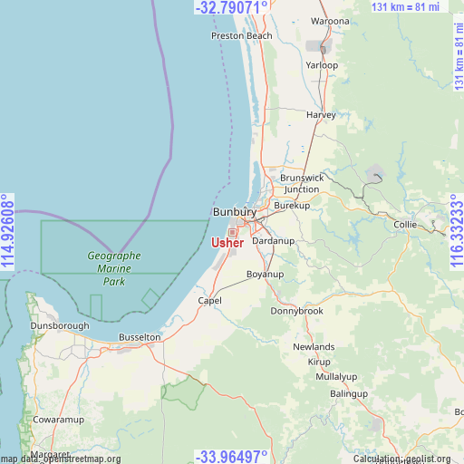
| Upper-left | -32.79071°, | 114.92608° |
| Center: | -33.37982°, | 115.6292° |
| Lower-right: | -33.96497°, | 116.33233° |
| Map W x H: | 130.6×130.6 km | = 81.2×81.2mi |
| max Lat: | -10.58257° ⇑45.3% North |
| Usher: | -33.37982° |
| min Lat: | ⇓54.7% South -43.31423° |
| min Long | Usher | max Long |
| 113.53327° | 115.6292° | 153.61246° |
| W 1.4%⇐ | ⇒98.6% E |
Elevation
Elevation of Usher is 19 m = 62 ft, and this is 103 m = 338 ft below average elevation for this country.
| Max E: |
1715 m = 5627 ft | 74.7% |
| Avg. | 122 m = 400 ft | |
| Usher | 19 m = 62 ft | |
Min E: |
-2 m = -7 ft | 25.3% |
See also: Australia elevation on elevation.city.
Geographical zone
Usher is located in South temperate zone (between Tropic of Capricorn and the Antarctic Circle). Distance of this Southern Tropic circle is 1105.6 km =687 mi to North.| Distance of | km | miles | from Usher |
|---|---|---|---|
| Equator | 3711.5 | 2306.2 | to North |
| Tropic Capricorn | 1105.6 | 687 | to North |
| Antarctic Circle | 3689.7 | 2292.7 | to South |
| South Pole | 6295.6 | 3911.9 | to South |


Nearby cities:
15 places around Usher: (largest is in red/bold)
• Australind
13.7 km =8.5 mi,  35°
35°
• Bunbury
6 km =3.7 mi,  10°
10°
• Carey Park
3.9 km =2.4 mi,  28°
28°
• College Grove
2.8 km =1.7 mi,  80°
80°
• Dalyellup
3.4 km =2.1 mi,  202°
202°
• Dardanup West
9.4 km =5.8 mi,  94°
94°
• East Bunbury
5.7 km =3.5 mi, 30°
• Eaton
9.9 km =6.2 mi,  45°
45°
• Gelorup
5.1 km =3.2 mi,  167°
167°
• Glen Iris
6.3 km =3.9 mi, 41°
• Millbridge
12.8 km =8 mi, 50°
• Pelican Point
9 km =5.6 mi, 40°
• South Bunbury
3.4 km =2.1 mi, 6°
• Stratham
10.1 km =6.3 mi, 203°
• Withers
1.3 km =0.8 mi, 5°
Sources, notices
• [Note1] Compared only with cities in Australia existing in our database
• [Src1] Map data: © OpenStreetMap contributors (CC-BY-SA)
• [Src2] Other city data from geonames.org with taken over terms of usage.
• [Src3] Geographical zone / Annual Mean Temperature by Robert A. Rohde @ Wikipedia
