Withers geodata
Withers (Western Australia) is a section of populated place; located in Australia in Australia/Perth (GMT+8) time zone. With population of 2,918 people, there are 2305 cities with bigger population in this country. Compared to other cities in Australia, 54.8% of cities are located further ↓South; 98.6% of cities are located further →East and 79% of cities have higher elevation than Withers. Note1


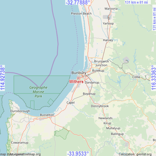
Withers GPS coordinates[2]
33° 22' 5.052" South, 115° 37' 49.8" East
| Map corner | latitude | longitude |
|---|---|---|
| Upper-left | -32.77888°, | 114.92738° |
| Center: | -33.36807°, | 115.6305° |
| Lower-right: | -33.9533°, | 116.33363° |
| Map W x H: | 130.6×130.6 km | = 81.2×81.2mi |
| max Lat: | -10.58257° ⇑45.2% North |
| Withers: | -33.36807° |
| min Lat: | ⇓54.8% South -43.31423° |
| min Long | Withers | max Long |
| 113.53327° | 115.6305° | 153.61246° |
| W 1.4%⇐ | ⇒98.6% E |
Elevation
Elevation of Withers is 16 m = 52 ft, and this is 106 m = 348 ft below average elevation for this country.
| Max E: |
1715 m = 5627 ft | 79% |
| Avg. | 122 m = 400 ft | |
| Withers | 16 m = 52 ft | |
Min E: |
-2 m = -7 ft | 21% |
See also: Australia elevation on elevation.city.
Geographical zone
Withers is located in South temperate zone (between Tropic of Capricorn and the Antarctic Circle). Distance of this Southern Tropic circle is 1104.3 km =686.2 mi to North.| Distance of | km | miles | from Withers |
|---|---|---|---|
| Equator | 3710.2 | 2305.4 | to North |
| Tropic Capricorn | 1104.3 | 686.2 | to North |
| Antarctic Circle | 3691 | 2293.5 | to South |
| South Pole | 6296.9 | 3912.7 | to South |


Nearby cities:
15 places around Withers: (largest is in red/bold)
• Australind
12.6 km =7.8 mi,  38°
38°
• Bunbury
4.7 km =2.9 mi,  12°
12°
• Carey Park
2.8 km =1.7 mi, 39°
• College Grove
2.8 km =1.7 mi,  108°
108°
• Dalyellup
4.7 km =2.9 mi,  197°
197°
• Dardanup West
9.4 km =5.8 mi,  102°
102°
• East Bunbury
4.5 km =2.8 mi, 38°
• Eaton
9 km =5.6 mi,  50°
50°
• Gelorup
6.3 km =3.9 mi,  171°
171°
• Glen Iris
5.3 km =3.3 mi, 49°
• Millbridge
11.9 km =7.4 mi, 54°
• Pelican Point
8 km =5 mi, 46°
• South Bunbury
2.1 km =1.3 mi, 7°
• Stratham
11.4 km =7.1 mi, 201°
• Usher
1.3 km =0.8 mi,  185°
185°
Sources, notices
• [Note1] Compared only with cities in Australia existing in our database
• [Src1] Map data: © OpenStreetMap contributors (CC-BY-SA)
• [Src2] Other city data from geonames.org with taken over terms of usage.
• [Src3] Geographical zone / Annual Mean Temperature by Robert A. Rohde @ Wikipedia
