Victory Heights geodata
Victory Heights (Western Australia) is a section of populated place; located in Australia in Australia/Perth (GMT+8) time zone. With population of 861 people, there are 4040 cities with bigger population in this country. Compared to other cities in Australia, 71.1% of cities are located further ↓South; 89.2% of cities are located further →East and 89.3% of cities have lower elevation than Victory Heights. Note1


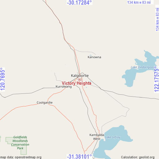
Victory Heights GPS coordinates[2]
30° 46' 43.752" South, 121° 28' 21.432" East
| Map corner | latitude | longitude |
|---|---|---|
| Upper-left | -30.17284°, | 120.7695° |
| Center: | -30.77882°, | 121.47262° |
| Lower-right: | -31.38101°, | 122.17575° |
| Map W x H: | 134.3×134.3 km | = 83.5×83.5mi |
| max Lat: | -10.58257° ⇑28.9% North |
| Victory Heights: | -30.77882° |
| min Lat: | ⇓71.1% South -43.31423° |
| min Long | Victory Heights | max Long |
| 113.53327° | 121.47262° | 153.61246° |
| W 10.8%⇐ | ⇒89.2% E |
Elevation
Elevation of Victory Heights is 354 m = 1161 ft, and this is 232 m = 761 ft above average elevation for this country.
| Max E: |
1715 m = 5627 ft | 10.7% |
| Victory Heights | 354 m 1161 ft | |
| Avg. | 122 m = 400 ft | |
Min E: |
-2 m = -7 ft | 89.3% |
See also: Australia elevation on elevation.city.
Geographical zone
Victory Heights is located in South temperate zone (between Tropic of Capricorn and the Antarctic Circle). Distance of this Southern Tropic circle is 816.4 km =507.3 mi to North.| Distance of | km | miles | from Victory Heights |
|---|---|---|---|
| Equator | 3422.3 | 2126.5 | to North |
| Tropic Capricorn | 816.4 | 507.3 | to North |
| Antarctic Circle | 3978.9 | 2472.4 | to South |
| South Pole | 6584.8 | 4091.6 | to South |


Nearby cities:
15 places around Victory Heights: (largest is in red/bold)
• Boulder
1.8 km =1.1 mi,  101°
101°
• Broadwood
2.1 km =1.3 mi,  232°
232°
• Coolgardie
35.3 km =21.9 mi,  236°
236°
• Hannans
6.9 km =4.3 mi,  345°
345°
• Kalgoorlie
3.6 km =2.2 mi,  2°
2°
• Kambalda East
51 km =31.7 mi,  158°
158°
• Kambalda West
49.4 km =30.7 mi, 162°
• Lamington
5.1 km =3.2 mi, 348°
• Norseman
160.4 km =99.7 mi,  169°
169°
• Piccadilly
4.1 km =2.5 mi, 348°
• Somerville
2 km =1.2 mi,  299°
299°
• South Kalgoorlie
1.5 km =0.9 mi, 2°
• Southern Cross
210.8 km =131 mi,  256°
256°
• Stoneville
29.7 km =18.5 mi,  109°
109°
• West Lamington
4 km =2.5 mi,  331°
331°
Sources, notices
• [Note1] Compared only with cities in Australia existing in our database
• [Src1] Map data: © OpenStreetMap contributors (CC-BY-SA)
• [Src2] Other city data from geonames.org with taken over terms of usage.
• [Src3] Geographical zone / Annual Mean Temperature by Robert A. Rohde @ Wikipedia
