Herbert geodata
Herbert (Northern Territory) is a section of populated place; located in Australia in Australia/Darwin (GMT+9.5) time zone. With population of 1,777 people, there are 3068 cities with bigger population in this country. Compared to other cities in Australia, 98.6% of cities are located further ↓South; 87.2% of cities are located further →East and 51.1% of cities have higher elevation than Herbert. Note1


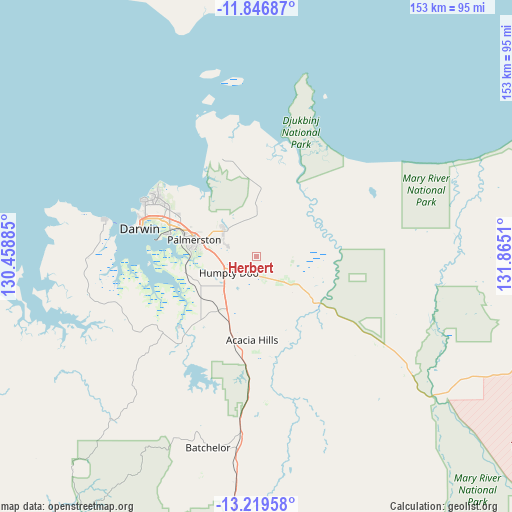
Herbert GPS coordinates[2]
12° 32' 2.904" South, 131° 9' 43.092" East
| Map corner | latitude | longitude |
|---|---|---|
| Upper-left | -11.84687°, | 130.45885° |
| Center: | -12.53414°, | 131.16197° |
| Lower-right: | -13.21958°, | 131.8651° |
| Map W x H: | 152.6×152.6 km | = 94.8×94.8mi |
| max Lat: | -10.58257° ⇑1.4% North |
| Herbert: | -12.53414° |
| min Lat: | ⇓98.6% South -43.31423° |
| min Long | Herbert | max Long |
| 113.53327° | 131.16197° | 153.61246° |
| W 12.8%⇐ | ⇒87.2% E |
Elevation
Elevation of Herbert is 44 m = 144 ft, and this is 78 m = 256 ft below average elevation for this country.
| Max E: |
1715 m = 5627 ft | 51.1% |
| Avg. | 122 m = 400 ft | |
| Herbert | 44 m = 144 ft | |
Min E: |
-2 m = -7 ft | 48.9% |
See also: Australia elevation on elevation.city.
Geographical zone
Herbert is located in South Torrid zone (between Equator and Tropic of Capricorn). Distance of this Southern Tropic circle is 1212.3 km =753.3 mi to South.| Distance of | km | miles | from Herbert |
|---|---|---|---|
| Equator | 1393.7 | 866 | to North |
| Tropic Capricorn | 1212.3 | 753.3 | to South |
| Antarctic Circle | 6007.5 | 3732.9 | to South |
| South Pole | 8613.4 | 5352.1 | to South |


Nearby cities:
15 places around Herbert: (largest is in red/bold)
• Bakewell
18.8 km =11.7 mi,  282°
282°
• Bees Creek
12.2 km =7.6 mi,  245°
245°
• Bellamack
19.5 km =12.1 mi, 275°
• Coolalinga
13.1 km =8.1 mi, 275°
• Farrar
18.8 km =11.7 mi,  288°
288°
• Girraween
7.3 km =4.5 mi, 277°
• Gunn
19 km =11.8 mi, 285°
• Holtze
19.5 km =12.1 mi,  299°
299°
• Howard Springs
13.5 km =8.4 mi, 288°
• Humpty Doo
6.2 km =3.9 mi,  206°
206°
• Johnston
17.1 km =10.6 mi, 287°
• McMinns Lagoon
9.4 km =5.8 mi,  260°
260°
• Rosebery
19.1 km =11.9 mi, 277°
• Virginia
14.6 km =9.1 mi, 276°
• Zuccoli
17.1 km =10.6 mi, 280°
Sources, notices
• [Note1] Compared only with cities in Australia existing in our database
• [Src1] Map data: © OpenStreetMap contributors (CC-BY-SA)
• [Src2] Other city data from geonames.org with taken over terms of usage.
• [Src3] Geographical zone / Annual Mean Temperature by Robert A. Rohde @ Wikipedia
