Madeley geodata
Madeley (Western Australia) is a section of populated place; located in Australia in Australia/Perth (GMT+8) time zone. With population of 5,946 people, there are 1215 cities with bigger population in this country. Compared to other cities in Australia, 68.1% of cities are located further ↓South; 95.4% of cities are located further →East and 58% of cities have lower elevation than Madeley. Note1


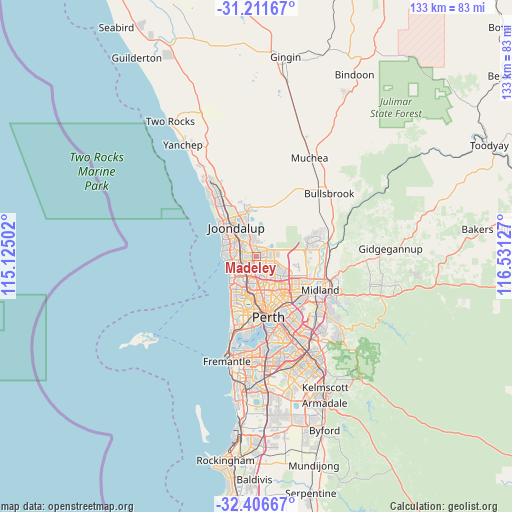
Madeley GPS coordinates[2]
31° 48' 39.96" South, 115° 49' 41.304" East
| Map corner | latitude | longitude |
|---|---|---|
| Upper-left | -31.21167°, | 115.12502° |
| Center: | -31.8111°, | 115.82814° |
| Lower-right: | -32.40667°, | 116.53127° |
| Map W x H: | 132.9×132.9 km | = 82.6×82.6mi |
| max Lat: | -10.58257° ⇑31.9% North |
| Madeley: | -31.8111° |
| min Lat: | ⇓68.1% South -43.31423° |
| min Long | Madeley | max Long |
| 113.53327° | 115.82814° | 153.61246° |
| W 4.6%⇐ | ⇒95.4% E |
Elevation
Elevation of Madeley is 59 m = 194 ft, and this is 63 m = 207 ft below average elevation for this country.
| Max E: |
1715 m = 5627 ft | 42% |
| Avg. | 122 m = 400 ft | |
| Madeley | 59 m = 194 ft | |
Min E: |
-2 m = -7 ft | 58% |
See also: Australia elevation on elevation.city.
Geographical zone
Madeley is located in South temperate zone (between Tropic of Capricorn and the Antarctic Circle). Distance of this Southern Tropic circle is 931.1 km =578.6 mi to North.| Distance of | km | miles | from Madeley |
|---|---|---|---|
| Equator | 3537.1 | 2197.9 | to North |
| Tropic Capricorn | 931.1 | 578.6 | to North |
| Antarctic Circle | 3864.1 | 2401 | to South |
| South Pole | 6470 | 4020.3 | to South |


Nearby cities:
15 places around Madeley: (largest is in red/bold)
• Alexander Heights
3.9 km =2.4 mi,  117°
117°
• Balga
5 km =3.1 mi,  167°
167°
• Darch
1.7 km =1.1 mi,  95°
95°
• Girrawheen
3.5 km =2.2 mi,  161°
161°
• Gnangara
5.3 km =3.3 mi,  42°
42°
• Greenwood
3 km =1.9 mi,  233°
233°
• Hamersley
4.6 km =2.9 mi,  204°
204°
• Hocking
4.7 km =2.9 mi,  348°
348°
• Kingsley
2.6 km =1.6 mi,  271°
271°
• Koondoola
5 km =3.1 mi,  132°
132°
• Landsdale
3.6 km =2.2 mi,  83°
83°
• Marangaroo
2 km =1.2 mi,  151°
151°
• Pearsall
3.5 km =2.2 mi,  344°
344°
• Warwick
3.7 km =2.3 mi,  210°
210°
• Woodvale
3.8 km =2.4 mi,  309°
309°
Sources, notices
• [Note1] Compared only with cities in Australia existing in our database
• [Src1] Map data: © OpenStreetMap contributors (CC-BY-SA)
• [Src2] Other city data from geonames.org with taken over terms of usage.
• [Src3] Geographical zone / Annual Mean Temperature by Robert A. Rohde @ Wikipedia
