Greystanes geodata
Greystanes (New South Wales) is a section of populated place; located in Australia in Australia/Sydney (GMT+11) time zone. With population of 22,591 people, there are 130 cities with bigger population in this country. Compared to other cities in Australia, 52.7% of cities are located further ↑North; 66.5% of cities are located further ←West and 63% of cities have lower elevation than Greystanes. Note1


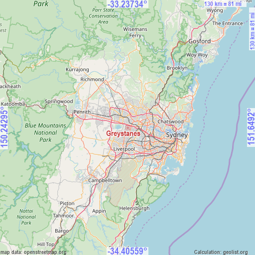
Greystanes GPS coordinates[2]
33° 49' 24.456" South, 150° 56' 45.852" East
| Map corner | latitude | longitude |
|---|---|---|
| Upper-left | -33.23734°, | 150.24295° |
| Center: | -33.82346°, | 150.94607° |
| Lower-right: | -34.40559°, | 151.6492° |
| Map W x H: | 129.9×129.9 km | = 80.7×80.7mi |
| max Lat: | -10.58257° ⇑52.7% North |
| Greystanes: | -33.82346° |
| min Lat: | ⇓47.3% South -43.31423° |
| min Long | Greystanes | max Long |
| 113.53327° | 150.94607° | 153.61246° |
| W 66.5%⇐ | ⇒33.5% E |
Elevation
Elevation of Greystanes is 73 m = 240 ft, and this is 49 m = 161 ft below average elevation for this country.
| Max E: |
1715 m = 5627 ft | 37% |
| Avg. | 122 m = 400 ft | |
| Greystanes | 73 m = 240 ft | |
Min E: |
-2 m = -7 ft | 63% |
See also: Australia elevation on elevation.city.
Geographical zone
Greystanes is located in South temperate zone (between Tropic of Capricorn and the Antarctic Circle). Distance of this Southern Tropic circle is 1154.9 km =717.6 mi to North.| Distance of | km | miles | from Greystanes |
|---|---|---|---|
| Equator | 3760.8 | 2336.9 | to North |
| Tropic Capricorn | 1154.9 | 717.6 | to North |
| Antarctic Circle | 3640.4 | 2262 | to South |
| South Pole | 6246.2 | 3881.2 | to South |


Nearby cities:
15 places around Greystanes: (largest is in red/bold)
• Constitution Hill
4.4 km =2.7 mi,  39°
39°
• Girraween
2.7 km =1.7 mi,  354°
354°
• Guildford West
3.4 km =2.1 mi,  149°
149°
• Merrylands
3.6 km =2.2 mi,  107°
107°
• Merrylands West
2.4 km =1.5 mi,  115°
115°
• Old Toongabbie
4.5 km =2.8 mi,  27°
27°
• Pemulwuy
2 km =1.2 mi,  272°
272°
• Pendle Hill
2.3 km =1.4 mi,  21°
21°
• Prospect
3.9 km =2.4 mi,  309°
309°
• Smithfield
3.2 km =2 mi,  201°
201°
• South Wentworthville
1.7 km =1.1 mi,  71°
71°
• Toongabbie
4.5 km =2.8 mi,  4°
4°
• Wentworthville
2.8 km =1.7 mi,  46°
46°
• Westmead
4.4 km =2.7 mi,  60°
60°
• Woodpark
2.4 km =1.5 mi, 146°
Sources, notices
• [Note1] Compared only with cities in Australia existing in our database
• [Src1] Map data: © OpenStreetMap contributors (CC-BY-SA)
• [Src2] Other city data from geonames.org with taken over terms of usage.
• [Src3] Geographical zone / Annual Mean Temperature by Robert A. Rohde @ Wikipedia
