Nollamara geodata
Nollamara (Western Australia) is a section of populated place; located in Australia in Australia/Perth (GMT+8) time zone. With population of 11,367 people, there are 471 cities with bigger population in this country. Compared to other cities in Australia, 67.2% of cities are located further ↓South; 94.9% of cities are located further →East and 62.4% of cities have lower elevation than Nollamara. Note1


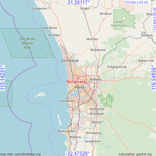
Nollamara GPS coordinates[2]
31° 52' 48.576" South, 115° 50' 43.548" East
| Map corner | latitude | longitude |
|---|---|---|
| Upper-left | -31.28117°, | 115.14231° |
| Center: | -31.88016°, | 115.84543° |
| Lower-right: | -32.47528°, | 116.54856° |
| Map W x H: | 132.8×132.8 km | = 82.5×82.5mi |
| max Lat: | -10.58257° ⇑32.8% North |
| Nollamara: | -31.88016° |
| min Lat: | ⇓67.2% South -43.31423° |
| min Long | Nollamara | max Long |
| 113.53327° | 115.84543° | 153.61246° |
| W 5.1%⇐ | ⇒94.9% E |
Elevation
Elevation of Nollamara is 71 m = 233 ft, and this is 51 m = 167 ft below average elevation for this country.
| Max E: |
1715 m = 5627 ft | 37.6% |
| Avg. | 122 m = 400 ft | |
| Nollamara | 71 m = 233 ft | |
Min E: |
-2 m = -7 ft | 62.4% |
See also: Australia elevation on elevation.city.
Geographical zone
Nollamara is located in South temperate zone (between Tropic of Capricorn and the Antarctic Circle). Distance of this Southern Tropic circle is 938.8 km =583.3 mi to North.| Distance of | km | miles | from Nollamara |
|---|---|---|---|
| Equator | 3544.7 | 2202.6 | to North |
| Tropic Capricorn | 938.8 | 583.3 | to North |
| Antarctic Circle | 3856.4 | 2396.3 | to South |
| South Pole | 6462.3 | 4015.5 | to South |


Nearby cities:
15 places around Nollamara: (largest is in red/bold)
• Balcatta
1.7 km =1.1 mi,  289°
289°
• Balga
2.8 km =1.7 mi,  349°
349°
• Coolbinia
3.9 km =2.4 mi,  175°
175°
• Dianella
2.7 km =1.7 mi,  109°
109°
• Girrawheen
4.4 km =2.7 mi, 353°
• Joondanna
3.1 km =1.9 mi,  185°
185°
• Koondoola
4.7 km =2.9 mi,  24°
24°
• Menora
4.6 km =2.9 mi,  159°
159°
• Mirrabooka
3 km =1.9 mi,  40°
40°
• Mount Hawthorn
4.5 km =2.8 mi, 192°
• Osborne Park
4 km =2.5 mi,  235°
235°
• Stirling
3.4 km =2.1 mi,  263°
263°
• Tuart Hill
2.2 km =1.4 mi,  206°
206°
• Westminster
1.5 km =0.9 mi,  337°
337°
• Yokine
2.4 km =1.5 mi, 162°
Sources, notices
• [Note1] Compared only with cities in Australia existing in our database
• [Src1] Map data: © OpenStreetMap contributors (CC-BY-SA)
• [Src2] Other city data from geonames.org with taken over terms of usage.
• [Src3] Geographical zone / Annual Mean Temperature by Robert A. Rohde @ Wikipedia
