Forrestfield geodata
Forrestfield (Western Australia) is a section of populated place; located in Australia in Australia/Perth (GMT+8) time zone. With population of 12,480 people, there are 384 cities with bigger population in this country. Compared to other cities in Australia, 65.4% of cities are located further ↓South; 92.3% of cities are located further →East and 51.1% of cities have higher elevation than Forrestfield. Note1


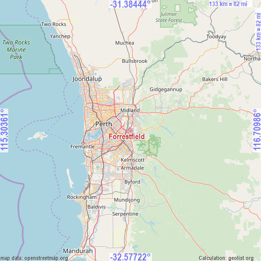
Forrestfield GPS coordinates[2]
31° 58' 57.972" South, 116° 0' 24.228" East
| Map corner | latitude | longitude |
|---|---|---|
| Upper-left | -31.38444°, | 115.30361° |
| Center: | -31.98277°, | 116.00673° |
| Lower-right: | -32.57722°, | 116.70986° |
| Map W x H: | 132.6×132.6 km | = 82.4×82.4mi |
| max Lat: | -10.58257° ⇑34.6% North |
| Forrestfield: | -31.98277° |
| min Lat: | ⇓65.4% South -43.31423° |
| min Long | Forrestfield | max Long |
| 113.53327° | 116.00673° | 153.61246° |
| W 7.7%⇐ | ⇒92.3% E |
Elevation
Elevation of Forrestfield is 44 m = 144 ft, and this is 78 m = 256 ft below average elevation for this country.
| Max E: |
1715 m = 5627 ft | 51.1% |
| Avg. | 122 m = 400 ft | |
| Forrestfield | 44 m = 144 ft | |
Min E: |
-2 m = -7 ft | 48.9% |
See also: Australia elevation on elevation.city.
Geographical zone
Forrestfield is located in South temperate zone (between Tropic of Capricorn and the Antarctic Circle). Distance of this Southern Tropic circle is 950.2 km =590.4 mi to North.| Distance of | km | miles | from Forrestfield |
|---|---|---|---|
| Equator | 3556.2 | 2209.7 | to North |
| Tropic Capricorn | 950.2 | 590.4 | to North |
| Antarctic Circle | 3845 | 2389.2 | to South |
| South Pole | 6450.9 | 4008.4 | to South |


Nearby cities:
15 places around Forrestfield: (largest is in red/bold)
• Beckenham
6.4 km =4 mi,  223°
223°
• Cloverdale
6.3 km =3.9 mi,  290°
290°
• East Cannington
5.7 km =3.5 mi,  238°
238°
• Gooseberry Hill
5.1 km =3.2 mi,  51°
51°
• Hazelmere
7.3 km =4.5 mi,  3°
3°
• High Wycombe
4.3 km =2.7 mi,  355°
355°
• Kalamunda
5 km =3.1 mi,  78°
78°
• Kenwick
6.8 km =4.2 mi,  213°
213°
• Kewdale
5.2 km =3.2 mi,  274°
274°
• Lesmurdie
4.5 km =2.8 mi,  118°
118°
• Maida Vale
4 km =2.5 mi,  29°
29°
• Orange Grove
5.2 km =3.2 mi,  181°
181°
• Queens Park
6.1 km =3.8 mi,  248°
248°
• Walliston
6.6 km =4.1 mi,  103°
103°
• Wattle Grove
2.7 km =1.7 mi,  192°
192°
Sources, notices
• [Note1] Compared only with cities in Australia existing in our database
• [Src1] Map data: © OpenStreetMap contributors (CC-BY-SA)
• [Src2] Other city data from geonames.org with taken over terms of usage.
• [Src3] Geographical zone / Annual Mean Temperature by Robert A. Rohde @ Wikipedia
