Hinchinbrook geodata
Hinchinbrook (New South Wales) is a section of populated place; located in Australia in Australia/Sydney (GMT+10) time zone. With population of 11,220 people, there are 482 cities with bigger population in this country. Compared to other cities in Australia, 56.7% of cities are located further ↑North; 64.3% of cities are located further ←West and 53.7% of cities have higher elevation than Hinchinbrook. Note1


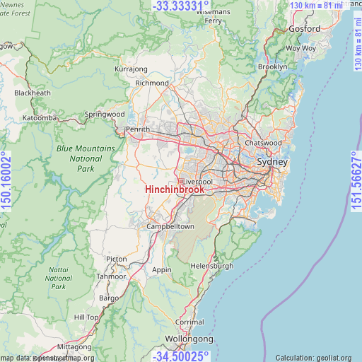
Hinchinbrook GPS coordinates[2]
33° 55' 7.608" South, 150° 51' 47.304" East
| Map corner | latitude | longitude |
|---|---|---|
| Upper-left | -33.33331°, | 150.16002° |
| Center: | -33.91878°, | 150.86314° |
| Lower-right: | -34.50025°, | 151.56627° |
| Map W x H: | 129.8×129.8 km | = 80.7×80.7mi |
| max Lat: | -10.58257° ⇑56.7% North |
| Hinchinbrook: | -33.91878° |
| min Lat: | ⇓43.3% South -43.31423° |
| min Long | Hinchinbrook | max Long |
| 113.53327° | 150.86314° | 153.61246° |
| W 64.3%⇐ | ⇒35.7% E |
Elevation
Elevation of Hinchinbrook is 40 m = 131 ft, and this is 82 m = 269 ft below average elevation for this country.
| Max E: |
1715 m = 5627 ft | 53.7% |
| Avg. | 122 m = 400 ft | |
| Hinchinbrook | 40 m = 131 ft | |
Min E: |
-2 m = -7 ft | 46.3% |
See also: Australia elevation on elevation.city.
Geographical zone
Hinchinbrook is located in South temperate zone (between Tropic of Capricorn and the Antarctic Circle). Distance of this Southern Tropic circle is 1165.5 km =724.2 mi to North.| Distance of | km | miles | from Hinchinbrook |
|---|---|---|---|
| Equator | 3771.4 | 2343.4 | to North |
| Tropic Capricorn | 1165.5 | 724.2 | to North |
| Antarctic Circle | 3629.8 | 2255.5 | to South |
| South Pole | 6235.6 | 3874.6 | to South |


Nearby cities:
15 places around Hinchinbrook: (largest is in red/bold)
• Ashcroft
3.4 km =2.1 mi,  84°
84°
• Bonnyrigg Heights
3.1 km =1.9 mi,  11°
11°
• Busby
1.8 km =1.1 mi,  62°
62°
• Carnes Hill
2.6 km =1.6 mi,  211°
211°
• Cartwright
2.5 km =1.6 mi,  105°
105°
• Elizabeth Hills
2.7 km =1.7 mi,  327°
327°
• Green Valley
1.8 km =1.1 mi, 11°
• Heckenberg
2.7 km =1.7 mi, 64°
• Horningsea Park
3.2 km =2 mi, 211°
• Hoxton Park
1.6 km =1 mi, 210°
• Middleton Grange
2 km =1.2 mi,  275°
275°
• Miller
2 km =1.2 mi,  96°
96°
• Prestons
2.7 km =1.7 mi,  162°
162°
• Sadleir
2.6 km =1.6 mi,  85°
85°
• West Hoxton
3.3 km =2.1 mi,  239°
239°
Sources, notices
• [Note1] Compared only with cities in Australia existing in our database
• [Src1] Map data: © OpenStreetMap contributors (CC-BY-SA)
• [Src2] Other city data from geonames.org with taken over terms of usage.
• [Src3] Geographical zone / Annual Mean Temperature by Robert A. Rohde @ Wikipedia
