Middleton Grange geodata
Middleton Grange (New South Wales) is a section of populated place; located in Australia in Australia/Sydney (GMT+11) time zone. With population of 5,181 people, there are 1434 cities with bigger population in this country. Compared to other cities in Australia, 56.7% of cities are located further ↑North; 63.6% of cities are located further ←West and 60% of cities have lower elevation than Middleton Grange. Note1


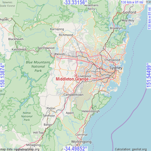
Middleton Grange GPS coordinates[2]
33° 55' 1.344" South, 150° 50' 30.696" East
| Map corner | latitude | longitude |
|---|---|---|
| Upper-left | -33.33156°, | 150.13874° |
| Center: | -33.91704°, | 150.84186° |
| Lower-right: | -34.49852°, | 151.54499° |
| Map W x H: | 129.8×129.8 km | = 80.7×80.7mi |
| max Lat: | -10.58257° ⇑56.7% North |
| Middleton Grange: | -33.91704° |
| min Lat: | ⇓43.3% South -43.31423° |
| min Long | Middleton Grang | max Long |
| 113.53327° | 150.84186° | 153.61246° |
| W 63.6%⇐ | ⇒36.4% E |
Elevation
Elevation of Middleton Grange is 64 m = 210 ft, and this is 58 m = 190 ft below average elevation for this country.
| Max E: |
1715 m = 5627 ft | 40% |
| Avg. | 122 m = 400 ft | |
| Middleton Grange | 64 m = 210 ft | |
Min E: |
-2 m = -7 ft | 60% |
See also: Australia elevation on elevation.city.
Geographical zone
Middleton Grange is located in South temperate zone (between Tropic of Capricorn and the Antarctic Circle). Distance of this Southern Tropic circle is 1165.3 km =724.1 mi to North.| Distance of | km | miles | from Middleton Grange |
|---|---|---|---|
| Equator | 3771.2 | 2343.3 | to North |
| Tropic Capricorn | 1165.3 | 724.1 | to North |
| Antarctic Circle | 3630 | 2255.6 | to South |
| South Pole | 6235.8 | 3874.7 | to South |


Nearby cities:
15 places around Middleton Grange: (largest is in red/bold)
• Austral
3.3 km =2.1 mi,  249°
249°
• Bonnyrigg Heights
3.9 km =2.4 mi,  42°
42°
• Busby
3.6 km =2.2 mi,  79°
79°
• Carnes Hill
2.5 km =1.6 mi,  164°
164°
• Cecil Hills
3.2 km =2 mi,  15°
15°
• Elizabeth Hills
2.1 km =1.3 mi,  14°
14°
• Green Valley
2.8 km =1.7 mi,  56°
56°
• Heckenberg
4.5 km =2.8 mi, 77°
• Hinchinbrook
2 km =1.2 mi,  95°
95°
• Horningsea Park
2.9 km =1.8 mi,  173°
173°
• Hoxton Park
1.9 km =1.2 mi,  144°
144°
• Miller
4 km =2.5 mi, 96°
• Prestons
3.9 km =2.4 mi, 135°
• Sadleir
4.5 km =2.8 mi,  90°
90°
• West Hoxton
2.1 km =1.3 mi,  205°
205°
Sources, notices
• [Note1] Compared only with cities in Australia existing in our database
• [Src1] Map data: © OpenStreetMap contributors (CC-BY-SA)
• [Src2] Other city data from geonames.org with taken over terms of usage.
• [Src3] Geographical zone / Annual Mean Temperature by Robert A. Rohde @ Wikipedia
