Wallaroo geodata
Wallaroo (New South Wales) is a section of populated place; located in Australia in Australia/Sydney (GMT+11) time zone. With population of 697 people, there are 4331 cities with bigger population in this country. Compared to other cities in Australia, 73.5% of cities are located further ↑North; 52.7% of cities are located further ←West and 96% of cities have lower elevation than Wallaroo. Note1


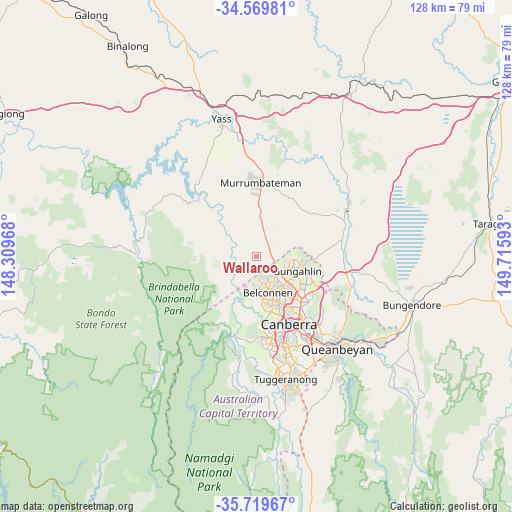
Wallaroo GPS coordinates[2]
35° 8' 48.372" South, 149° 0' 46.08" East
| Map corner | latitude | longitude |
|---|---|---|
| Upper-left | -34.56981°, | 148.30968° |
| Center: | -35.14677°, | 149.0128° |
| Lower-right: | -35.71967°, | 149.71593° |
| Map W x H: | 127.9×127.9 km | = 79.5×79.5mi |
| max Lat: | -10.58257° ⇑73.5% North |
| Wallaroo: | -35.14677° |
| min Lat: | ⇓26.5% South -43.31423° |
| min Long | Wallaroo | max Long |
| 113.53327° | 149.0128° | 153.61246° |
| W 52.7%⇐ | ⇒47.3% E |
Elevation
Elevation of Wallaroo is 604 m = 1982 ft, and this is 482 m = 1581 ft above average elevation for this country.
| Max E: |
1715 m = 5627 ft | 4% |
| Wallaroo | 604 m 1982 ft | |
| Avg. | 122 m = 400 ft | |
Min E: |
-2 m = -7 ft | 96% |
See also: Australia elevation on elevation.city.
Geographical zone
Wallaroo is located in South temperate zone (between Tropic of Capricorn and the Antarctic Circle). Distance of this Southern Tropic circle is 1302 km =809 mi to North.| Distance of | km | miles | from Wallaroo |
|---|---|---|---|
| Equator | 3908 | 2428.3 | to North |
| Tropic Capricorn | 1302 | 809 | to North |
| Antarctic Circle | 3493.2 | 2170.6 | to South |
| South Pole | 6099.1 | 3789.8 | to South |


Nearby cities:
15 places around Wallaroo: (largest is in red/bold)
• Casey
7.8 km =4.8 mi,  106°
106°
• Charnwood
6.2 km =3.9 mi,  161°
161°
• Dunlop
5.3 km =3.3 mi,  173°
173°
• Evatt
8.9 km =5.5 mi,  144°
144°
• Florey
9.4 km =5.8 mi, 158°
• Flynn
7.2 km =4.5 mi, 156°
• Fraser
5.8 km =3.6 mi,  149°
149°
• Higgins
9.6 km =6 mi, 172°
• Holt
8.6 km =5.3 mi,  180°
180°
• Latham
7.9 km =4.9 mi, 167°
• Macgregor
7 km =4.3 mi, 181°
• Melba
8 km =5 mi, 151°
• Ngunnawal
9.4 km =5.8 mi, 107°
• Nicholls
8.8 km =5.5 mi,  120°
120°
• Spence
7.4 km =4.6 mi, 140°
Sources, notices
• [Note1] Compared only with cities in Australia existing in our database
• [Src1] Map data: © OpenStreetMap contributors (CC-BY-SA)
• [Src2] Other city data from geonames.org with taken over terms of usage.
• [Src3] Geographical zone / Annual Mean Temperature by Robert A. Rohde @ Wikipedia
