Riverton geodata
Riverton (Western Australia) is a section of populated place; located in Australia in Australia/Perth (GMT+8) time zone. With population of 5,547 people, there are 1332 cities with bigger population in this country. Compared to other cities in Australia, 64.5% of cities are located further ↓South; 93.9% of cities are located further →East and 83.5% of cities have higher elevation than Riverton. Note1


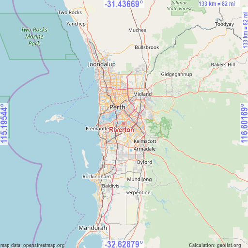
Riverton GPS coordinates[2]
32° 2' 4.848" South, 115° 53' 54.816" East
| Map corner | latitude | longitude |
|---|---|---|
| Upper-left | -31.43669°, | 115.19544° |
| Center: | -32.03468°, | 115.89856° |
| Lower-right: | -32.62879°, | 116.60169° |
| Map W x H: | 132.5×132.5 km | = 82.3×82.3mi |
| max Lat: | -10.58257° ⇑35.5% North |
| Riverton: | -32.03468° |
| min Lat: | ⇓64.5% South -43.31423° |
| min Long | Riverton | max Long |
| 113.53327° | 115.89856° | 153.61246° |
| W 6.1%⇐ | ⇒93.9% E |
Elevation
Elevation of Riverton is 13 m = 43 ft, and this is 109 m = 358 ft below average elevation for this country.
| Max E: |
1715 m = 5627 ft | 83.5% |
| Avg. | 122 m = 400 ft | |
| Riverton | 13 m = 43 ft | |
Min E: |
-2 m = -7 ft | 16.5% |
See also: Australia elevation on elevation.city.
Geographical zone
Riverton is located in South temperate zone (between Tropic of Capricorn and the Antarctic Circle). Distance of this Southern Tropic circle is 956 km =594 mi to North.| Distance of | km | miles | from Riverton |
|---|---|---|---|
| Equator | 3561.9 | 2213.3 | to North |
| Tropic Capricorn | 956 | 594 | to North |
| Antarctic Circle | 3839.3 | 2385.6 | to South |
| South Pole | 6445.1 | 4004.8 | to South |


Nearby cities:
15 places around Riverton: (largest is in red/bold)
• Canning Vale
3.2 km =2 mi,  144°
144°
• Cannington
4.1 km =2.5 mi,  60°
60°
• Ferndale
2.2 km =1.4 mi,  90°
90°
• Karawara
3.3 km =2.1 mi,  330°
330°
• Langford
4.1 km =2.5 mi,  99°
99°
• Lynwood
2.9 km =1.8 mi, 101°
• Manning
3.6 km =2.2 mi,  305°
305°
• Parkwood
2.5 km =1.6 mi,  130°
130°
• Rossmoyne
3 km =1.9 mi,  259°
259°
• Salter Point
3.3 km =2.1 mi,  291°
291°
• Shelley
1.3 km =0.8 mi,  296°
296°
• St James
4 km =2.5 mi,  15°
15°
• Waterford
2.4 km =1.5 mi, 331°
• Willetton
2.2 km =1.4 mi,  207°
207°
• Wilson
2 km =1.2 mi,  38°
38°
Sources, notices
• [Note1] Compared only with cities in Australia existing in our database
• [Src1] Map data: © OpenStreetMap contributors (CC-BY-SA)
• [Src2] Other city data from geonames.org with taken over terms of usage.
• [Src3] Geographical zone / Annual Mean Temperature by Robert A. Rohde @ Wikipedia
