Inglewood geodata
Inglewood (Western Australia) is a section of populated place; located in Australia in Australia/Perth (GMT+8) time zone. With population of 5,529 people, there are 1340 cities with bigger population in this country. Compared to other cities in Australia, 66.4% of cities are located further ↓South; 94.1% of cities are located further →East and 64.8% of cities have higher elevation than Inglewood. Note1


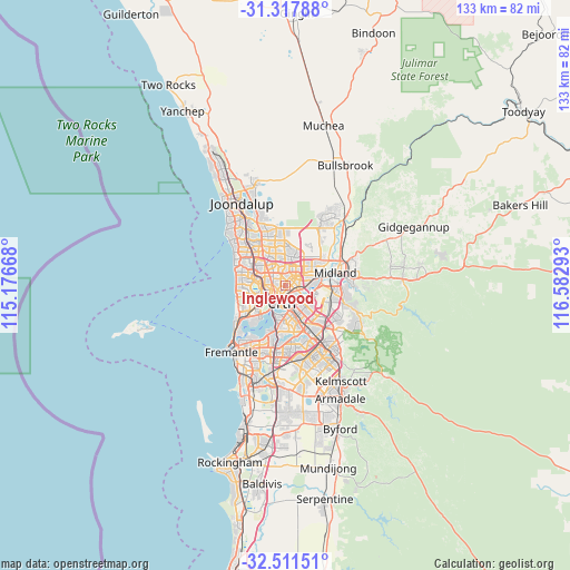
Inglewood GPS coordinates[2]
31° 54' 59.868" South, 115° 52' 47.28" East
| Map corner | latitude | longitude |
|---|---|---|
| Upper-left | -31.31788°, | 115.17668° |
| Center: | -31.91663°, | 115.8798° |
| Lower-right: | -32.51151°, | 116.58293° |
| Map W x H: | 132.7×132.7 km | = 82.5×82.5mi |
| max Lat: | -10.58257° ⇑33.6% North |
| Inglewood: | -31.91663° |
| min Lat: | ⇓66.4% South -43.31423° |
| min Long | Inglewood | max Long |
| 113.53327° | 115.8798° | 153.61246° |
| W 5.9%⇐ | ⇒94.1% E |
Elevation
Elevation of Inglewood is 27 m = 89 ft, and this is 95 m = 312 ft below average elevation for this country.
| Max E: |
1715 m = 5627 ft | 64.8% |
| Avg. | 122 m = 400 ft | |
| Inglewood | 27 m = 89 ft | |
Min E: |
-2 m = -7 ft | 35.2% |
See also: Australia elevation on elevation.city.
Geographical zone
Inglewood is located in South temperate zone (between Tropic of Capricorn and the Antarctic Circle). Distance of this Southern Tropic circle is 942.9 km =585.9 mi to North.| Distance of | km | miles | from Inglewood |
|---|---|---|---|
| Equator | 3548.8 | 2205.1 | to North |
| Tropic Capricorn | 942.9 | 585.9 | to North |
| Antarctic Circle | 3852.4 | 2393.8 | to South |
| South Pole | 6458.3 | 4013 | to South |


Nearby cities:
15 places around Inglewood: (largest is in red/bold)
• Bayswater
3.6 km =2.2 mi,  90°
90°
• Bedford
1.1 km =0.7 mi,  56°
56°
• Coolbinia
2.9 km =1.8 mi,  274°
274°
• Dianella
3.2 km =2 mi,  346°
346°
• Embleton
3.1 km =1.9 mi, 62°
• Highgate
2.7 km =1.7 mi,  199°
199°
• Joondanna
3.7 km =2.3 mi,  285°
285°
• Leederville
4.2 km =2.6 mi,  238°
238°
• Maylands
2.1 km =1.3 mi,  138°
138°
• Menora
1.7 km =1.1 mi,  261°
261°
• Mount Hawthorn
4.2 km =2.6 mi, 264°
• Mount Lawley
2.1 km =1.3 mi, 201°
• North Perth
2.8 km =1.7 mi,  245°
245°
• Northbridge
4 km =2.5 mi,  209°
209°
• Yokine
3 km =1.9 mi,  304°
304°
Sources, notices
• [Note1] Compared only with cities in Australia existing in our database
• [Src1] Map data: © OpenStreetMap contributors (CC-BY-SA)
• [Src2] Other city data from geonames.org with taken over terms of usage.
• [Src3] Geographical zone / Annual Mean Temperature by Robert A. Rohde @ Wikipedia
