Lake Clifton geodata
Lake Clifton (Western Australia) is a section of populated place; located in Australia in Australia/Perth (GMT+8) time zone. With population of 656 people, there are 4421 cities with bigger population in this country. Compared to other cities in Australia, 59.6% of cities are located further ↓South; 98.4% of cities are located further →East and 86.8% of cities have higher elevation than Lake Clifton. Note1


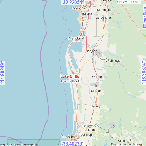
Lake Clifton GPS coordinates[2]
32° 48' 48.348" South, 115° 41' 8.196" East
| Map corner | latitude | longitude |
|---|---|---|
| Upper-left | -32.22054°, | 114.98249° |
| Center: | -32.81343°, | 115.68561° |
| Lower-right: | -33.40239°, | 116.38874° |
| Map W x H: | 131.4×131.4 km | = 81.6×81.6mi |
| max Lat: | -10.58257° ⇑40.4% North |
| Lake Clifton: | -32.81343° |
| min Lat: | ⇓59.6% South -43.31423° |
| min Long | Lake Clifton | max Long |
| 113.53327° | 115.68561° | 153.61246° |
| W 1.6%⇐ | ⇒98.4% E |
Elevation
Elevation of Lake Clifton is 11 m = 36 ft, and this is 111 m = 364 ft below average elevation for this country.
| Max E: |
1715 m = 5627 ft | 86.8% |
| Avg. | 122 m = 400 ft | |
| Lake Clifton | 11 m = 36 ft | |
Min E: |
-2 m = -7 ft | 13.2% |
See also: Australia elevation on elevation.city.
Geographical zone
Lake Clifton is located in South temperate zone (between Tropic of Capricorn and the Antarctic Circle). Distance of this Southern Tropic circle is 1042.6 km =647.8 mi to North.| Distance of | km | miles | from Lake Clifton |
|---|---|---|---|
| Equator | 3648.5 | 2267.1 | to North |
| Tropic Capricorn | 1042.6 | 647.8 | to North |
| Antarctic Circle | 3752.7 | 2331.8 | to South |
| South Pole | 6358.6 | 3951 | to South |


Nearby cities:
15 places around Lake Clifton: (largest is in red/bold)
• Bouvard
11.4 km =7.1 mi,  337°
337°
• Coodanup
29.8 km =18.5 mi,  12°
12°
• Cookernup
26.7 km =16.6 mi,  137°
137°
• Dawesville
20.8 km =12.9 mi,  345°
345°
• Dudley Park
29.4 km =18.3 mi, 8°
• Erskine
28.6 km =17.8 mi,  3°
3°
• Falcon
25.8 km =16 mi,  355°
355°
• Furnissdale
29.2 km =18.1 mi, 13°
• Halls Head
30.1 km =18.7 mi, 1°
• North Yunderup
28.1 km =17.5 mi,  21°
21°
• Pinjarra
26.9 km =16.7 mi,  40°
40°
• Ravenswood
29.1 km =18.1 mi,  27°
27°
• South Yunderup
26.9 km =16.7 mi, 19°
• Wannanup
24.1 km =15 mi, 350°
• Waroona
22.3 km =13.9 mi,  98°
98°
Sources, notices
• [Note1] Compared only with cities in Australia existing in our database
• [Src1] Map data: © OpenStreetMap contributors (CC-BY-SA)
• [Src2] Other city data from geonames.org with taken over terms of usage.
• [Src3] Geographical zone / Annual Mean Temperature by Robert A. Rohde @ Wikipedia
