Wallaga Lake geodata
Wallaga Lake (New South Wales) is a populated place; located in Australia in Australia/Sydney (GMT+11) time zone. With population of 524 people, there are 4801 cities with bigger population in this country. Compared to other cities in Australia, 79.7% of cities are located further ↑North; 57.1% of cities are located further ←West and 65.9% of cities have higher elevation than Wallaga Lake. Note1


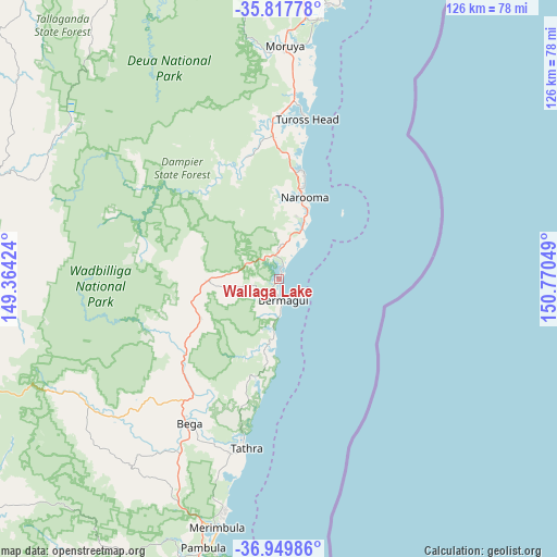
Wallaga Lake GPS coordinates[2]
36° 23' 9.168" South, 150° 4' 2.496" East
| Map corner | latitude | longitude |
|---|---|---|
| Upper-left | -35.81778°, | 149.36424° |
| Center: | -36.38588°, | 150.06736° |
| Lower-right: | -36.94986°, | 150.77049° |
| Map W x H: | 125.9×125.9 km | = 78.2×78.2mi |
| max Lat: | -10.58257° ⇑79.7% North |
| Wallaga Lake: | -36.38588° |
| min Lat: | ⇓20.3% South -43.31423° |
| min Long | Wallaga Lake | max Long |
| 113.53327° | 150.06736° | 153.61246° |
| W 57.1%⇐ | ⇒42.9% E |
Elevation
Elevation of Wallaga Lake is 26 m = 85 ft, and this is 96 m = 315 ft below average elevation for this country.
| Max E: |
1715 m = 5627 ft | 65.9% |
| Avg. | 122 m = 400 ft | |
| Wallaga Lake | 26 m = 85 ft | |
Min E: |
-2 m = -7 ft | 34.1% |
See also: Australia elevation on elevation.city.
Geographical zone
Wallaga Lake is located in South temperate zone (between Tropic of Capricorn and the Antarctic Circle). Distance of this Southern Tropic circle is 1439.8 km =894.6 mi to North.| Distance of | km | miles | from Wallaga Lake |
|---|---|---|---|
| Equator | 4045.7 | 2513.9 | to North |
| Tropic Capricorn | 1439.8 | 894.6 | to North |
| Antarctic Circle | 3355.4 | 2084.9 | to South |
| South Pole | 5961.3 | 3704.2 | to South |


Nearby cities:
15 places around Wallaga Lake: (largest is in red/bold)
• Bega
37.8 km =23.5 mi,  212°
212°
• Bemboka
51.9 km =32.2 mi,  238°
238°
• Bermagui
3.7 km =2.3 mi,  185°
185°
• Bodalla
32.8 km =20.4 mi,  357°
357°
• Candelo
53.9 km =33.5 mi,  218°
218°
• Cobargo
16.2 km =10.1 mi,  269°
269°
• Dalmeny
25.1 km =15.6 mi,  12°
12°
• Kalaru
40.3 km =25 mi,  197°
197°
• Kianga
21.9 km =13.6 mi, 14°
• Moruya
52.7 km =32.7 mi,  1°
1°
• Moruya Heads
52.6 km =32.7 mi, 8°
• Narooma
19.6 km =12.2 mi,  17°
17°
• North Narooma
20.7 km =12.9 mi, 11°
• Tathra
39.1 km =24.3 mi, 191°
• Tuross Head
37.5 km =23.3 mi, 9°
Sources, notices
• [Note1] Compared only with cities in Australia existing in our database
• [Src1] Map data: © OpenStreetMap contributors (CC-BY-SA)
• [Src2] Other city data from geonames.org with taken over terms of usage.
• [Src3] Geographical zone / Annual Mean Temperature by Robert A. Rohde @ Wikipedia
