Lopare geodata
Lopare (Srpska) is a seat of a second-order administrative division; located in Bosnia and Herzegovina in Europe/Sarajevo (GMT+2) time zone. With population of 3,614 people, there are 192 cities with bigger population in this country. Compared to other cities in Bosnia and Herzegovina, 64.2% of cities are located further ↓South; 89.1% of cities are located further ←West and 61.9% of cities have higher elevation than Lopare. Note1


Lopare GPS coordinates[2]
44° 38' 5.928" North, 18° 50' 36.24" East
| Map corner | latitude | longitude |
|---|---|---|
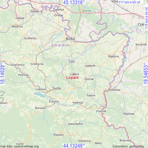
| Upper-left | 45.13316°, | 18.14028° |
| Center: | 44.63498°, | 18.8434° |
| Lower-right: | 44.13248°, | 19.54653° |
| Map W x H: | 111.3×111.3 km | = 69.2×69.2mi |
| max Lat: | 45.21956° ⇑35.8% North |
| Lopare: | 44.63498° |
| min Lat: | ⇓64.2% South 42.71197° |
| min Long | Lopare | max Long |
| 15.77806° | 18.8434° | 19.36719° |
| W 89.1%⇐ | ⇒10.9% E |
Elevation
Elevation of Lopare is 231 m = 758 ft, and this is 128.5 m = 422 ft below average elevation for this country.
| Max E: |
1175 m = 3855 ft | 61.9% |
| Avg. | 359.5 m = 1179 ft | |
| Lopare | 231 m = 758 ft | |
Min E: |
17 m = 56 ft | 38.1% |
See also: Bosnia and Herzegovina elevation on elevation.city.
Geographical zone
Lopare is located in North temperate zone (between Tropic of Cancer and the Arctic Circle). Distance of this Northern Tropic circle is 2357 km =1464.6 mi to South.| Distance of | km | miles | from Lopare |
|---|---|---|---|
| North Pole | 5044.1 | 3134.3 | to North |
| Arctic Circle | 2438.2 | 1515 | to North |
| Tropic Cancer | 2357 | 1464.6 | to South |
| Equator | 4962.9 | 3083.8 | to South |


Nearby cities:
15 places around Lopare: (largest is in red/bold)
• Brka
23.5 km =14.6 mi,  336°
336°
• Dubrave Donje
20.7 km =12.9 mi,  214°
214°
• Dubrave Gornje
20.3 km =12.6 mi, 207°
• Gornja Tuzla
10.9 km =6.8 mi,  216°
216°
• Kalesija
22.5 km =14 mi,  167°
167°
• Mramor
22.6 km =14 mi,  257°
257°
• Priboj
7.9 km =4.9 mi,  117°
117°
• Sapna
19.1 km =11.9 mi,  139°
139°
• Solina
14.4 km =8.9 mi,  235°
235°
• Teočak
11.3 km =7 mi,  108°
108°
• Tojšići
15.6 km =9.7 mi,  197°
197°
• Tuzla
17.6 km =10.9 mi,  232°
232°
• Ugljevik
14.3 km =8.9 mi,  77°
77°
• Vukovije Donje
20.6 km =12.8 mi, 201°
• Čelić
10.3 km =6.4 mi,  347°
347°
Sources, notices
• [Note1] Compared only with cities in Bosnia and Herzegovina existing in our database
• [Src1] Map data: © OpenStreetMap contributors (CC-BY-SA)
• [Src2] Other city data from geonames.org with taken over terms of usage.
• [Src3] Geographical zone / Annual Mean Temperature by Robert A. Rohde @ Wikipedia
