Brodac-Gornji geodata
Brodac-Gornji (Srpska) is a populated place; located in Bosnia and Herzegovina in Europe/Sarajevo (GMT+2) time zone. With population of 967 people, there are 226 cities with bigger population in this country. Compared to other cities in Bosnia and Herzegovina, 78.9% of cities are located further ↓South; 97.7% of cities are located further ←West and 97% of cities have higher elevation than Brodac-Gornji. Note1


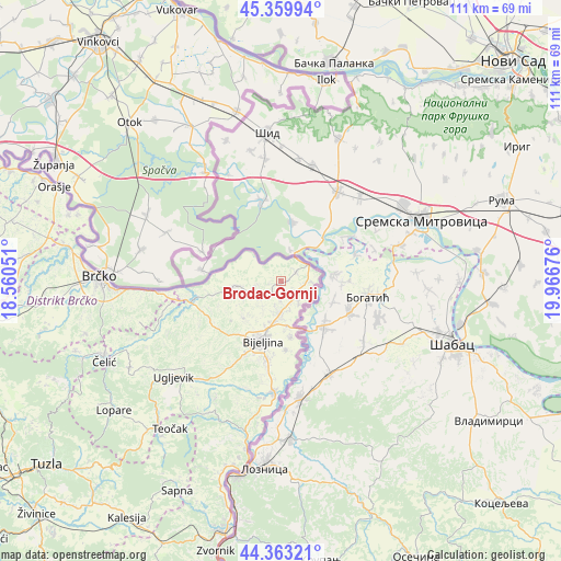
Brodac-Gornji GPS coordinates[2]
44° 51' 49.428" North, 19° 15' 49.068" East
| Map corner | latitude | longitude |
|---|---|---|
| Upper-left | 45.35994°, | 18.56051° |
| Center: | 44.86373°, | 19.26363° |
| Lower-right: | 44.36321°, | 19.96676° |
| Map W x H: | 110.8×110.8 km | = 68.8×68.8mi |
| max Lat: | 45.21956° ⇑21.1% North |
| Brodac-Gornji: | 44.86373° |
| min Lat: | ⇓78.9% South 42.71197° |
| min Long | Brodac-Gornji | max Long |
| 15.77806° | 19.26363° | 19.36719° |
| W 97.7%⇐ | ⇒2.3% E |
Elevation
Elevation of Brodac-Gornji is 81 m = 266 ft, and this is 278.5 m = 914 ft below average elevation for this country.
| Max E: |
1175 m = 3855 ft | 97% |
| Avg. | 359.5 m = 1179 ft | |
| Brodac-Gornji | 81 m = 266 ft | |
Min E: |
17 m = 56 ft | 3% |
See also: Bosnia and Herzegovina elevation on elevation.city.
Geographical zone
Brodac-Gornji is located in North temperate zone (between Tropic of Cancer and the Arctic Circle). Distance of this Northern Tropic circle is 2382.5 km =1480.4 mi to South.| Distance of | km | miles | from Brodac-Gornji |
|---|---|---|---|
| North Pole | 5018.7 | 3118.5 | to North |
| Arctic Circle | 2412.8 | 1499.2 | to North |
| Tropic Cancer | 2382.5 | 1480.4 | to South |
| Equator | 4988.4 | 3099.6 | to South |


Nearby cities:
15 places around Brodac-Gornji: (largest is in red/bold)
• Balatun
6 km =3.7 mi,  90°
90°
• Bijeljina
12.3 km =7.6 mi,  198°
198°
• Brka
42.7 km =26.5 mi,  264°
264°
• Brčko
35.7 km =22.2 mi,  271°
271°
• Dvorovi
6.3 km =3.9 mi,  182°
182°
• Janja
22.1 km =13.7 mi, 183°
• Kojčinovac
19.4 km =12.1 mi,  185°
185°
• Lopare
41.8 km =26 mi,  232°
232°
• Ostojićevo
2.5 km =1.6 mi, 257°
• Popovi
11.1 km =6.9 mi,  170°
170°
• Priboj
39.1 km =24.3 mi,  222°
222°
• Teočak
36.6 km =22.7 mi, 217°
• Ugljevik
29.4 km =18.3 mi, 220°
• Velika Obarska
10.4 km =6.5 mi, 230°
• Čelić
38.6 km =24 mi,  246°
246°
Sources, notices
• [Note1] Compared only with cities in Bosnia and Herzegovina existing in our database
• [Src1] Map data: © OpenStreetMap contributors (CC-BY-SA)
• [Src2] Other city data from geonames.org with taken over terms of usage.
• [Src3] Geographical zone / Annual Mean Temperature by Robert A. Rohde @ Wikipedia
