Waarschoot geodata
Waarschoot (Flanders) is a populated place; located in Belgium in Europe/Brussels (GMT+2) time zone. With population of 7,762 people, there are 374 cities with bigger population in this country. Compared to other cities in Belgium, 85.7% of cities are located further ↓South; 84.7% of cities are located further →East and 96% of cities have higher elevation than Waarschoot. Note1
Administrative division(s):
- Level 1: Flanders
- Level 2: Provincie Oost-Vlaanderen
- Level 3: Arrondissement Gent
- Level 4: Lievegem


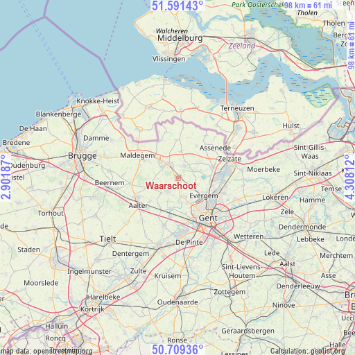
Waarschoot GPS coordinates[2]
51° 9' 9" North, 3° 36' 18" East
| Map corner | latitude | longitude |
|---|---|---|
| Upper-left | 51.59143°, | 2.90187° |
| Center: | 51.1525°, | 3.605° |
| Lower-right: | 50.70936°, | 4.30812° |
| Map W x H: | 98.1×98.1 km | = 61×61mi |
| max Lat: | 51.46791° ⇑14.3% North |
| Waarschoot: | 51.1525° |
| min Lat: | ⇓85.7% South 49.53771° |
| min Long | Waarschoot | max Long |
| 2.59368° | 3.605° | 6.25749° |
| W 15.3%⇐ | ⇒84.7% E |
Elevation
Elevation of Waarschoot is 6 m = 20 ft, and this is 93.5 m = 307 ft below average elevation for this country.
| Max E: |
582 m = 1909 ft | 96% |
| Avg. | 99.5 m = 326 ft | |
| Waarschoot | 6 m = 20 ft | |
Min E: |
1 m = 3 ft | 4% |
See also: Belgium elevation on elevation.city.
Geographical zone
Waarschoot is located in North temperate zone (between Tropic of Cancer and the Arctic Circle). Distance of this North polar circle is 1713.5 km =1064.7 mi to North.| Distance of | km | miles | from Waarschoot |
|---|---|---|---|
| North Pole | 4319.4 | 2683.9 | to North |
| Arctic Circle | 1713.5 | 1064.7 | to North |
| Tropic Cancer | 3081.7 | 1914.9 | to South |
| Equator | 5687.6 | 3534.1 | to South |


Nearby cities:
15 places around Waarschoot: (largest is in red/bold)
• Aalter
13 km =8.1 mi,  237°
237°
• Assenede
13 km =8.1 mi,  51°
51°
• Eeklo
5.1 km =3.2 mi,  318°
318°
• Evergem
8.5 km =5.3 mi,  120°
120°
• Gent
13.8 km =8.6 mi,  145°
145°
• Kaprijke
7.2 km =4.5 mi,  5°
5°
• Knesselare
13.5 km =8.4 mi,  263°
263°
• Lovendegem
5.7 km =3.5 mi,  174°
174°
• Maldegem
12.7 km =7.9 mi,  298°
298°
• Nevele
13.7 km =8.5 mi,  197°
197°
• Sint-Laureins
11.4 km =7.1 mi,  330°
330°
• Sint-Margriete
15 km =9.3 mi,  344°
344°
• Sint-Martens-Latem
15.5 km =9.6 mi, 171°
• Zelzate
14.7 km =9.1 mi,  73°
73°
• Zomergem
4.6 km =2.9 mi,  217°
217°
Sources, notices
• [Note1] Compared only with cities in Belgium existing in our database
• [Src1] Map data: © OpenStreetMap contributors (CC-BY-SA)
• [Src2] Other city data from geonames.org with taken over terms of usage.
• [Src3] Geographical zone / Annual Mean Temperature by Robert A. Rohde @ Wikipedia
