Assenede geodata
Assenede (Flanders) is a populated place; located in Belgium in Europe/Brussels (GMT+2) time zone. With population of 13,495 people, there are 219 cities with bigger population in this country. Compared to other cities in Belgium, 93.1% of cities are located further ↓South; 81% of cities are located further →East and 99.5% of cities have higher elevation than Assenede. Note1
Administrative division(s):
- Level 1: Flanders
- Level 2: Provincie Oost-Vlaanderen
- Level 3: Arrondissement Eeklo
- Level 4: Assenede


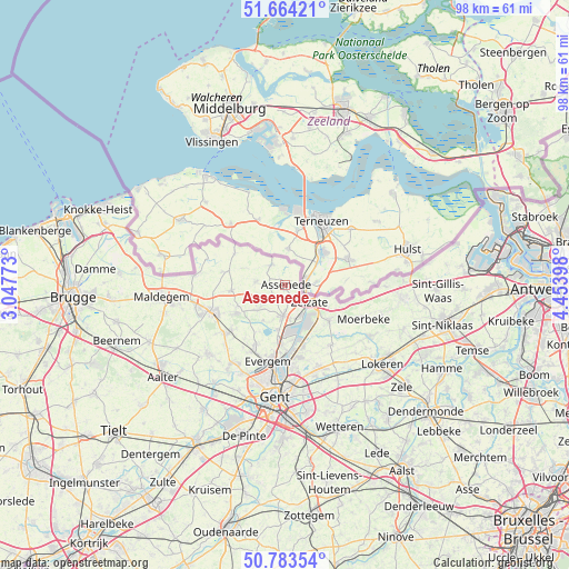
Assenede GPS coordinates[2]
51° 13' 33.528" North, 3° 45' 3.06" East
| Map corner | latitude | longitude |
|---|---|---|
| Upper-left | 51.66421°, | 3.04773° |
| Center: | 51.22598°, | 3.75085° |
| Lower-right: | 50.78354°, | 4.45398° |
| Map W x H: | 97.9×97.9 km | = 60.8×60.8mi |
| max Lat: | 51.46791° ⇑6.9% North |
| Assenede: | 51.22598° |
| min Lat: | ⇓93.1% South 49.53771° |
| min Long | Assenede | max Long |
| 2.59368° | 3.75085° | 6.25749° |
| W 19%⇐ | ⇒81% E |
Elevation
Elevation of Assenede is 3 m = 10 ft, and this is 96.5 m = 317 ft below average elevation for this country.
| Max E: |
582 m = 1909 ft | 99.5% |
| Avg. | 99.5 m = 326 ft | |
| Assenede | 3 m = 10 ft | |
Min E: |
1 m = 3 ft | 0.5% |
See also: Belgium elevation on elevation.city.
Geographical zone
Assenede is located in North temperate zone (between Tropic of Cancer and the Arctic Circle). Distance of this North polar circle is 1705.4 km =1059.7 mi to North.| Distance of | km | miles | from Assenede |
|---|---|---|---|
| North Pole | 4311.3 | 2678.9 | to North |
| Arctic Circle | 1705.4 | 1059.7 | to North |
| Tropic Cancer | 3089.9 | 1920 | to South |
| Equator | 5695.8 | 3539.2 | to South |


Nearby cities:
15 places around Assenede: (largest is in red/bold)
• Destelbergen
18.8 km =11.7 mi,  169°
169°
• Eeklo
14.2 km =8.8 mi,  252°
252°
• Evergem
12.9 km =8 mi,  192°
192°
• Gent
19.7 km =12.2 mi, 186°
• Kaprijke
9.5 km =5.9 mi,  264°
264°
• Lochristi
15.5 km =9.6 mi,  158°
158°
• Lovendegem
16.8 km =10.4 mi,  214°
214°
• Moerbeke
13.8 km =8.6 mi,  114°
114°
• Sint-Laureins
15.9 km =9.9 mi,  276°
276°
• Sint-Margriete
15.5 km =9.6 mi,  293°
293°
• Stekene
20 km =12.4 mi,  95°
95°
• Waarschoot
13 km =8.1 mi,  231°
231°
• Wachtebeke
10.6 km =6.6 mi,  127°
127°
• Zelzate
5.7 km =3.5 mi,  135°
135°
• Zomergem
17.5 km =10.9 mi, 227°
Sources, notices
• [Note1] Compared only with cities in Belgium existing in our database
• [Src1] Map data: © OpenStreetMap contributors (CC-BY-SA)
• [Src2] Other city data from geonames.org with taken over terms of usage.
• [Src3] Geographical zone / Annual Mean Temperature by Robert A. Rohde @ Wikipedia
