Charleroi geodata
Charleroi (Wallonia) is a populated place; located in Belgium in Europe/Brussels (GMT+2) time zone. With population of 200,132 people, there are 3 cities with bigger population in this country. Compared to other cities in Belgium, 83% of cities are located further ↑North; 57.8% of cities are located further →East and 73.3% of cities have lower elevation than Charleroi. Note1
Administrative division(s):
- Level 1: Wallonia
- Level 2: Province du Hainaut
- Level 3: Arrondissement de Charleroi
- Level 4: Charleroi


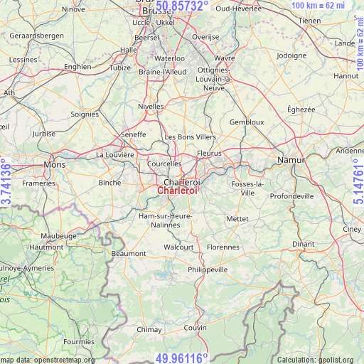
Charleroi GPS coordinates[2]
50° 24' 40.896" North, 4° 26' 40.128" East
| Map corner | latitude | longitude |
|---|---|---|
| Upper-left | 50.85732°, | 3.74136° |
| Center: | 50.41136°, | 4.44448° |
| Lower-right: | 49.96116°, | 5.14761° |
| Map W x H: | 99.6×99.6 km | = 61.9×61.9mi |
| max Lat: | 51.46791° ⇑83% North |
| Charleroi: | 50.41136° |
| min Lat: | ⇓17% South 49.53771° |
| min Long | Charleroi | max Long |
| 2.59368° | 4.44448° | 6.25749° |
| W 42.2%⇐ | ⇒57.8% E |
Elevation
Elevation of Charleroi is 136 m = 446 ft, and this is 36.5 m = 120 ft above average elevation for this country.
| Max E: |
582 m = 1909 ft | 26.7% |
| Charleroi | 136 m 446 ft | |
| Avg. | 99.5 m = 326 ft | |
Min E: |
1 m = 3 ft | 73.3% |
See also: Charleroi elevation on elevation.city.
Geographical zone
Charleroi is located in North temperate zone (between Tropic of Cancer and the Arctic Circle). Distance of this North polar circle is 1796 km =1116 mi to North.| Distance of | km | miles | from Charleroi |
|---|---|---|---|
| North Pole | 4401.8 | 2735.2 | to North |
| Arctic Circle | 1796 | 1116 | to North |
| Tropic Cancer | 2999.3 | 1863.7 | to South |
| Equator | 5605.2 | 3482.9 | to South |


Nearby cities:
15 places around Charleroi: (largest is in red/bold)
• Aiseau
10.1 km =6.3 mi,  89°
89°
• Anderlues
12.3 km =7.6 mi,  267°
267°
• Brunehault
10.5 km =6.5 mi,  355°
355°
• Chapelle-lez-Herlaimont
13.3 km =8.3 mi,  300°
300°
• Châtelet
6 km =3.7 mi,  98°
98°
• Courcelles
7.6 km =4.7 mi,  319°
319°
• Farciennes
7.2 km =4.5 mi,  73°
73°
• Fleurus
11 km =6.8 mi,  42°
42°
• Gerpinnes
10.1 km =6.3 mi,  144°
144°
• La Bruyère
12.2 km =7.6 mi, 98°
• Lobbes
14.2 km =8.8 mi,  242°
242°
• Morlanwelz-Mariemont
14.9 km =9.3 mi,  288°
288°
• Pont-à-Celles
11.7 km =7.3 mi,  332°
332°
• Sombreffe
17.1 km =10.6 mi, 40°
• Thuin
13.8 km =8.6 mi,  234°
234°
Sources, notices
• [Note1] Compared only with cities in Belgium existing in our database
• [Src1] Map data: © OpenStreetMap contributors (CC-BY-SA)
• [Src2] Other city data from geonames.org with taken over terms of usage.
• [Src3] Geographical zone / Annual Mean Temperature by Robert A. Rohde @ Wikipedia
